Near Appomattox in Appomattox County, Virginia — The American South (Mid-Atlantic)
“Salute of Arms”
Inscription.
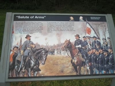
On April 12, 1865, Union Brig. Gen. Joshua Chamberlain watched the distant ridge as the Confederates prepared for the surrender. They formed into column, marched into the valley, then up the Richmond-Lynchburg Stage Road toward the village. As the column approached this knoll, Chamberlain ordered his men to honor them. The Federals snapped to “carry arms” – the “marching salute.”
A surprised Maj. Gen. John B. Gordon instantly ordered his men to return the salute. Until now, the drama at Appomattox had been played out by major figures. But here was a profound expression of respect by the armies’ common soldiers. They, more than anyone else, would blaze the path to reconciliation in the years that followed.
Erected by Appomattox Court House National Historical Park, National Park Service, Dept. of the Interior.
Topics. This historical marker is listed in this topic list: War, US Civil. A significant historical month for this entry is April 1862.
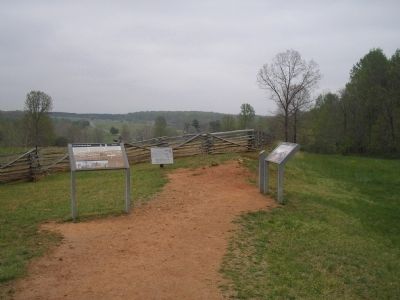
Location. 37° 22.729′ N, 78° 47.542′ W. Marker is near Appomattox, Virginia, in Appomattox County. Marker is on Richmond-Lynchburg Stage Road, on the right when traveling east. Marker is in the Appomattox Court House National Historical Park. It is located at the eastern end of the Richmond-Lynchburg Stage Road. Touch for map. Marker is at or near this postal address: 413 George Peers Dr, Appomattox VA 24522, United States of America. Touch for directions.
Other nearby markers. At least 8 other markers are within walking distance of this marker. Grant and Lee Meeting (here, next to this marker); Lee and Grant Meet (a few steps from this marker); Last Artillery Shots (about 500 feet away, measured in a direct line); Final Combat (about 500 feet away); The Surrender Ceremony (about 600 feet away); County Jail (approx. 0.2 miles away); Clover Hill Tavern (approx. 0.2 miles away); Appomattox River (approx. ¼ mile away). Touch for a list and map of all markers in Appomattox.
More about this marker. The background of the marker features a picture of Confederate Gen. John Gordon and Union Gen. Chamberlain, along with their respective armies.
“It was a scene worthy of a pilgrimage.” Brig. Gen. Joshua L. Chamberlain, USA
Also see . . .
1. Appomattox Court House National Historical Park. (Submitted on March 2, 2008, by Bill Coughlin of Woodland Park, New Jersey.)
2. Salute of Honor by Mort Kunstler. The Civil War Siege of Petersburg. (Submitted on December 21, 2008, by Bill Coughlin of Woodland Park, New Jersey.)
Credits. This page was last revised on March 28, 2021. It was originally submitted on March 2, 2008, by Bill Coughlin of Woodland Park, New Jersey. This page has been viewed 3,469 times since then and 51 times this year. Last updated on March 4, 2008, by Bill Coughlin of Woodland Park, New Jersey. Photos: 1, 2, 3. submitted on March 2, 2008, by Bill Coughlin of Woodland Park, New Jersey. 4. submitted on March 27, 2021, by Bradley Owen of Morgantown, West Virginia. • Craig Swain was the editor who published this page.


