
Palo Seco in Toa Baja in Municipio de Toa Baja, Puerto Rico — The Caribbean (The West Indies)
Imagine Life Here
⎯⎯⎯
Imagine Vivir Aquí
Photographed by Don Morfe, April 20, 2012
1. Imagine Life Here Marker

Imagine Life Here
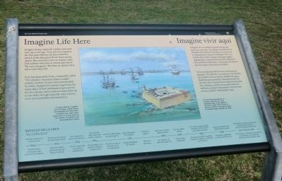
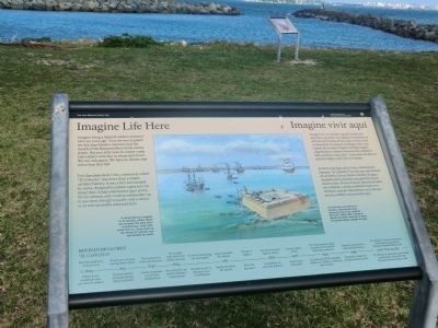
Imagine being a Spanish soldier stationed here 350 years ago. Your job was to guard the San Juan Harbor entrance and the mouth of the Bayamón River from enemy attack. But year after year no enemy came. Did soldiers welcome or dread duty here? We can only guess. We have no diaries that tell us how they felt.
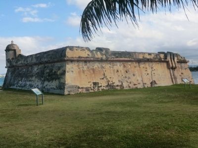
Fort San Juan de la Cruz, commonly called “El Cañuelo,” was more than a simple artillery battery. It was a fort surrounded by water, designed to sustain a garrison for many days. It had embrasures (gun ports) for six cannon, and could accommodate up to 200 men, through typically only a dozen or so were probably stationed here.
Caption:
A vessel delivers supplies to El Cañuelo, while others rest beneath the fort’s watchful eye. Until 1943, when the U.S. Army built up the island, El Cañuelo was surrounded by water.
Imagine ser un soldado español destacado aquí hace 350 años. Su trabajo era defender la entrada de la bahía de San Juan y la boca del río Bayamón de ataques enemigos. Pero con el paso de los años ningún enemigo llegaba. ¿Agradecían o temían esta tarea los
this page online
El fortín San Juan de la Cruz, comúnmente llamado "El Cañuelo", era más que una batería de artillería. Era un fuerte rodeado de agua, diseñado para sustentar una guarnición por muchos días. Poseía troneras (aberturas) para seis cañones, y podía acomodar hasta 200 militares, aunque típicamente cerca de una docena estaban estacionados aquí.
Pie de dibujo:
Un navío lleva provisiones al Cañuelo, mientras que otros descansan bajo el ojo vigilante del fortín. Hasta 1943, cuando el ejército de EEUU construyó el islote, El Cañuelo estaba rodeado de agua.
Erected by National Park Service, U.S. Department of the Interior.
Topics. This historical marker is listed in these topic lists: Colonial Era • Forts and Castles. A significant historical year for this entry is 1943.
Location. 18° 27.997′ N, 66° 8.182′ W. Marker is in Toa Baja in Municipio de Toa Baja, Puerto Rico. It is in Palo Seco. It is on State Highway 870. Touch for map. Marker is in this post office area: Toa Baja PR 00949, United States of America. Touch for directions.

Regionally,
Photographed by Don Morfe, April 20, 2012
2. Imagine Life Here Marker
Other nearby markers. At least 8 other markers are within 2 kilometers of this marker, measured as the crow flies: Defending San Juan / Defensa de San Juan (within shouting distance of this marker); Crossfire / Fuego cruzado (within shouting distance of this marker); A Never-Ending Challenge / Un Trabajo Que Nunca Se Acaba (within shouting distance of this marker); The Main Plaza / Plaza principal (approx. 1.4 kilometers away); A Defense of the 1st Order (approx. 1.4 kilometers away); The Dutch Attack of 1625 (approx. 1.5 kilometers away); Kites (approx. 1.6 kilometers away); Plaza del Cuartel (approx. 1.7 kilometers away). Touch for a list and map of all markers in Toa Baja.
Another marker is no longer nearby. Defending San Juan / Defensa de San Juan (was approx. 1.6 kilometers away but has been permanently removed).
Photographed by Don Morfe, April 20, 2012
3. Imagine Life Here Marker
Photographed by Don Morfe, April 20, 2012
4. Imagine Life Here Marker
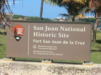
Photographed by Don Morfe, April 20, 2012
5. Imagine Life Here Marker
Credits. This page was last revised on June 9, 2023. It was originally submitted on October 5, 2012, by Don Morfe of Baltimore, Maryland. This page has been viewed 538 times since then and 13 times this year. Photos: 1, 2, 3, 4, 5. submitted on October 5, 2012, by Don Morfe of Baltimore, Maryland. • Bill Pfingsten was the editor who published this page.
