Central Business District in Sacramento in Sacramento County, California — The American West (Pacific Coastal)
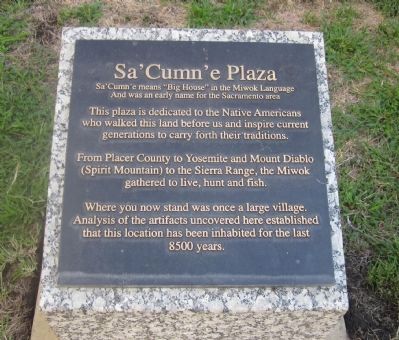
Sa’ Cumn’e Plaza
And was an early name for the Sacramento area
This plaza is dedicated to the Native Americans who walked this land before us and inspire current generations to carry forth their traditions.
From Placer County to Yosemite and Mount Diablo (Spirit Mountain) to the Sierra Range, the Miwok gathered to live, hunt and fish.
Where you now stand was once a large village. Analysis of the artifacts uncovered here established that this location has been inhabited for the last 8500 years.
Erected by City of Sacramento.
Topics. This historical marker is listed in this topic list: Native Americans.
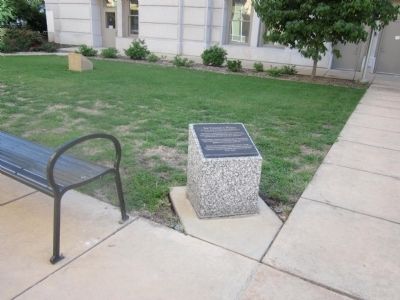
Location. 38° 34.924′ N, 121° 29.606′ W. Marker is in Sacramento, California, in Sacramento County. It is in the Central Business District. Marker can be reached from I Street, on the right when traveling west. The marker is located in the Plaza area between the rear of the old City Hall building and the entrance to the new City Hall Building. Between 9th and 10th Streets. Touch for map. Marker is at or near this postal address: 951 I Street, Sacramento CA 95814, United States of America. Touch for directions.
Other nearby markers. At least 8 other markers are within walking distance of this marker. Williams House (about 300 feet away, measured in a direct line); Young America Engine Co. No. 6 (about 400 feet away); Old City Plaza (about 500 feet away); United States Post Office, Courthouse, & Federal Building (about 500 feet away); A.J. Stevens Monument (about 500 feet away); Tony's Corner (approx. 0.2 miles away); Site of First and Second State Capitols at Sacramento (approx. 0.2 miles away); Site of First African Methodist Episcopal Church on the Pacific Coast (approx. 0.2 miles away). Touch for a list and map of all markers in Sacramento.
Credits. This page was last revised on February 7, 2023. It was originally submitted on October 6, 2012, by Syd Whittle of Mesa, Arizona. This page has been viewed 549 times since then and 18 times this year. Photos: 1, 2. submitted on October 6, 2012, by Syd Whittle of Mesa, Arizona.

