Near Locust Grove in Orange County, Virginia — The American South (Mid-Atlantic)
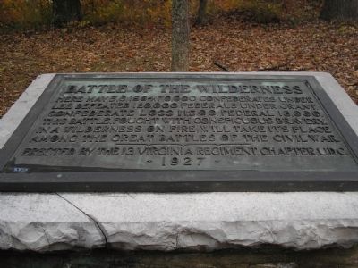
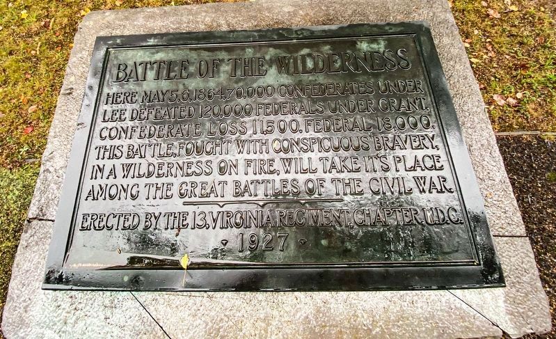
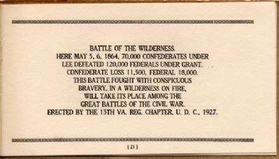
Battle of the Wilderness
Erected by the 13, Virginia Regiment, Chapter U.D.C. 1927
Erected 1927 by 13, Virginia Regiment, Chapter U.D.C.
Topics and series. This historical marker is listed in this topic list: War, US Civil. In addition, it is included in the Battlefield Markers Association, and the United Daughters of the Confederacy series lists. A significant historical month for this entry is May 1975.
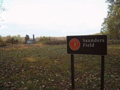
Location. 38° 18.965′ N, 77° 45.557′ W. Marker is near Locust Grove, Virginia, in Orange County. Marker is at the intersection of Hill-Ewell Drive and Constitution Highway (Virginia Route 20), on the left when traveling south on Hill-Ewell Drive. The marker is in the Wilderness Battlefield, at Stop Three (Saunders Field) on the driving tour. Touch for map. Marker is in this post office area: Locust Grove VA 22508, United States of America. Touch for directions.
Other nearby markers. At least 8 other markers are within walking distance of this marker. The Confederate Line (a few steps from this marker); “A Wild, Wicked Roar” (a few steps from this marker); The Confederate Defense (about 400 feet away, measured in a direct line); a different marker also named "A Wild, Wicked Roar" (about 400 feet away); 140th New York State Vols. (about 700 feet away); First Blood in Saunders Field (approx. 0.2 miles away); Gordon Flank Attack Trail (approx. 0.2 miles away); a different marker also named The Battle of the Wilderness (approx. 0.2 miles away). Touch for a list and map of all markers in Locust Grove.
Related markers. Click here for a list of markers that are related to this marker. Wilderness Battlefield - Hill-Ewell Drive virtual tour by markers.
Also see . . . Battle of the Wilderness. (Submitted on March 6, 2008, by Bill Coughlin of Woodland Park, New Jersey.)
Photographed By Craig Swain, February 16, 2008
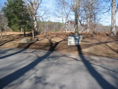
3. Battle of the Wilderness Marker
The pedestal for the marker is on the right. To the left is a "compass" pointing out the direction and distance to key points on the battlefield. The compass is a feature repeated throughout the Chancellorsville, Wilderness, and Spotsylvania Court House battlefields.
Photographed By Craig Swain, February 16, 2008
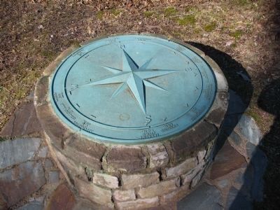
6. Compass Points for the Battle of the Wilderness
At several locations in the Central Virginia Battlefields, bronze pointers such as this one indicate the locations related points of interest. Here Parker's Store (along the Orange Plank Road) is indicated as 2.9 miles south. Spotsylvania Court House is 13 miles to the southeast. Culpeper Court House is 17 miles to the northwest. Orange Court House is 20 miles west. Richmond is 60 miles almost due south. And Appomattox Court House is 95 miles southwest.
Credits. This page was last revised on August 21, 2021. It was originally submitted on March 6, 2008, by Bill Coughlin of Woodland Park, New Jersey. This page has been viewed 2,149 times since then and 61 times this year. Photos: 1. submitted on March 6, 2008, by Bill Coughlin of Woodland Park, New Jersey. 2. submitted on August 16, 2021, by J.T. Lambrou of New Boston, Michigan. 3. submitted on March 7, 2008, by Craig Swain of Leesburg, Virginia. 4. submitted on March 6, 2008, by Bill Coughlin of Woodland Park, New Jersey. 5. submitted on June 22, 2018, by Allen C. Browne of Silver Spring, Maryland. 6. submitted on April 27, 2008, by Craig Swain of Leesburg, Virginia. 7. submitted on December 9, 2008, by Bernard Fisher of Richmond, Virginia. • Craig Swain was the editor who published this page.
