Otter Creek in Nashville in Davidson County, Tennessee — The American South (East South Central)
Battle of Nashville
(December 16, 1864)
| — | Assault on the Barricade | — |
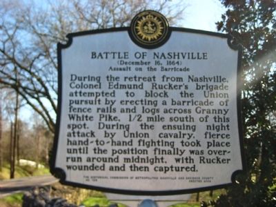
Photographed by Kevin Hoch, March 9, 2012
1. Battle of Nashville Marker
Erected 2005 by The Historical Commission of Metropolitan Nashville and Davidson County. (Marker Number 126.)
Topics and series. This historical marker is listed in this topic list: War, US Civil. In addition, it is included in the Tennessee, The Historical Commission of Metropolitan Nashville and Davidson County series list.
Location. 36° 3.056′ N, 86° 48.984′ W. Marker is in Nashville, Tennessee, in Davidson County. It is in Otter Creek. It is at the intersection of Granny White Pike and Richland Woods Lane/Club Drive, on the right when traveling south on Granny White Pike. Located just off of Granny White Pike at the road to the entrance to Richlands Country Club. Touch for map.
this page online

Regionally, this marker is in Middle Tennessee. It is also in the American South and specifically in the Upper South. Globally, it is in North America, the Western Hemisphere, the Western World, and the Anglosphere. Historically, it finds itself in what was once the territory of the Mississippian Culture, one of the Confederate States of America, and the Antebellum South.
Other nearby markers. At least 8 other markers are within 2 miles of this marker, measured as the crow flies: Vanderbilt Dyer Observatory (approx. 0.6 miles away); Johnson Chapel United Methodist Church (approx. one mile away); Granny White Grave (approx. 1.6 miles away); The Stone Box Indian Site (approx. 1.8 miles away); Nobles Corner (approx. 1.9 miles away); a different marker also named Noble's Corner (approx. 1.9 miles away); Davidson County / Williamson County (approx. 1.9 miles away); Forrest's Brentwood Raid (approx. 2 miles away). Touch for a list and map of all markers in Nashville.
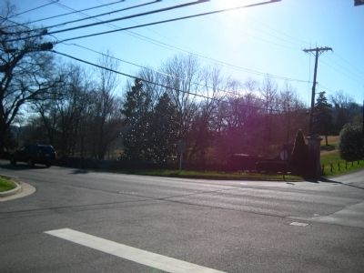
Photographed by Kevin Hoch, March 9, 2012
2. Battle of Nashville Marker
Credits. This page was last revised on February 7, 2023. It was originally submitted on March 9, 2012, by Kevin Hoch of Waco, Texas. This page has been viewed 2,113 times since then and 88 times this year. Last updated on October 11, 2012, by Kevin Hoch of Waco, Texas. Photos: 1, 2. submitted on March 9, 2012, by Kevin Hoch of Waco, Texas. • Bill Pfingsten was the editor who published this page.
