Locust Grove in Orange County, Virginia — The American South (Mid-Atlantic)
Grant’s Headquarters
The Battle of the Wilderness
— Fredericksburg and Spotsylvania National Military Park —
Inscription.
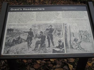
On May 5, 1864, this knoll was bordered by a second growth of scraggly pines and scrub oak. From here Grant and Meade could see little of the battle. Instead, they relied on subordinates to keep them apprised of the situation at the front. In the evenings the generals retired to their camp at the foot of the knoll, between here and the Germanna Plank Road (Modern Route 3). Otherwise, they rarely left this spot.
Over the next three days, as the two armies grappled in the deep woods, Grant and Meade remained at this knoll, sending and receiving dispatches as they fed troops into the battle. More than once Meade lost his temper. Outwardly Grant remained calm, but his nervous puffing of cigars and whittling of sticks showed that he too felt the strain.
“Grant and Meade…spent most of the day at their post on the hill, waiting for further intelligence. They sat or lay on the ground, and discussed the chances, and studied their maps, and read the dispatches…and listened constantly for the outburst of musketry which should tell that the battle was renewed.”
- Adam Badeau, Aide-de-camp
Erected by National Park Service, U.S. Department of the Interior.
Topics. This historical marker is listed in this topic list: War, US Civil. A significant historical month for this entry is May 1849.
Location. 38° 19.355′ N, 77° 44.043′ W. Marker is in Locust Grove, Virginia, in Orange County. Marker can be reached from Constitution Highway (Virginia Route 20), on the right when traveling west. Located at stop one (Grant's Headquarters) of the driving tour of Wilderness Battlefield. Touch for map. Marker is in this post office area: Locust Grove VA 22508, United States of America. Touch for directions.
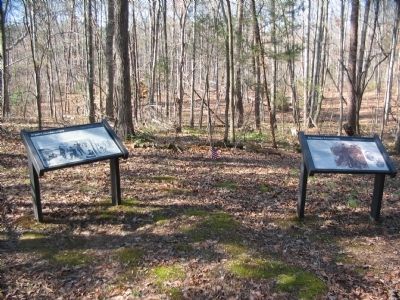
Other nearby markers. At least 8 other markers are within walking distance of this marker. An Uneasy Partnership (here, next to this marker); Grant Comes to Virginia (within shouting distance of this marker); The Campaign of 1781 (about 500 feet away, measured in a direct line); Ellwood - Home and Workplace (approx. ¼ mile away); Toil Without Choice at Ellwood (approx. ¼ mile away); The Yard: A Busy Place (approx. ¼ mile away); A Busy Place (approx. ¼ mile away); Archeology at Ellwood (approx. ¼ mile away). Touch for a list and map of all markers in Locust Grove.
More about this marker. The bottom left of the map features a picture of Grant at his headquarters with the caption An artist’s depiction of Grant’s headquarters knoll. The Orange Turnpike (modern Route 20) is at left.
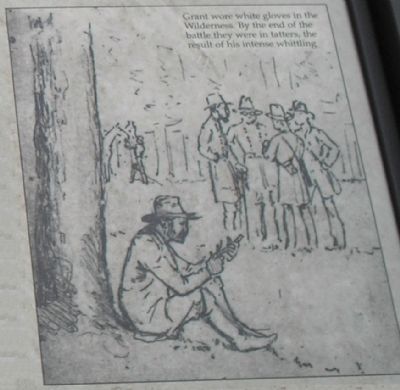
At the bottom right is a sketch of Grant sitting under a tree and whittling. Grant wore white gloves in the Wilderness. By the end of the battle they were in tatters, the result of his intense whittling.
Also see . . . Battle of the Wilderness. (Submitted on March 7, 2008, by Bill Coughlin of Woodland Park, New Jersey.)
Credits. This page was last revised on April 21, 2020. It was originally submitted on March 7, 2008, by Bill Coughlin of Woodland Park, New Jersey. This page has been viewed 1,902 times since then and 21 times this year. Photos: 1. submitted on March 7, 2008, by Bill Coughlin of Woodland Park, New Jersey. 2. submitted on March 8, 2008, by Craig Swain of Leesburg, Virginia. 3, 4. submitted on March 7, 2008, by Bill Coughlin of Woodland Park, New Jersey. • Craig Swain was the editor who published this page.


