Scotland in St. Mary's County, Maryland — The American Northeast (Mid-Atlantic)
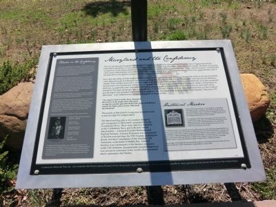
Maryland and the Confederacy
Soon after the firing on Fort Sumter, South Carolina, which ignited the war, Baltimore became the scene of the first bloodshed when Massachusetts and Pennsylvania troops passing thru the city on their way to Washington were attacked by Baltimore citizens. Four soldiers and twelve citizens were killed, while nineteen legislators, the mayor of Baltimore and other prominent secessionists were imprisoned without trial or appeal. The U.S. government supervised Maryland’s affairs, manipulated its elections, occupied the state with large contingents of troops and prevented any further action or discussion about secession. The local newspaper editor, John Downs of the St. Mary’s County Beacon, was imprisoned here at Point Lookout and the paper was operated under Federal supervision. The Maryland state song, by James Ryder Randal, “Maryland, My Maryland,” was composed and adopted as a result of these actions.
“The despot’s heel is on thy shore, Maryland! His torch is at thy temple door, Maryland! Avenge the patriotic gore that flecked the streets of Baltimore. And be the battle queen of yore, Maryland! My Maryland!
Thousands of Maryland’s young men streamed south to join the fight for independence.
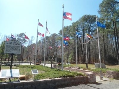
The Maryland flag pole is of a nautical design to give recognition to Maryland’s prominence in the Confederate Navy. There were only two Admirals in the Confederate Navy and both were native Marylanders---Admirals Franklin Buchanan was Raphael Semmes. Admiral Buchanan was commander of the first ironclad ship, the CSS Virginia, at Hampton Roads and later Commander of the ironclad, CSS Tennessee, at the battle of Mobile Bay. Admiral Semmes was Commander of the famous commerce raider CSS Alabama. Quartermaster Joseph Ridgeway was second in command of the world’s first successful attack submarine, the Hunley.
Blacks in the Confederacy
In 1862 when abolitionist Frederick Douglass met with Abraham Lincoln to persuade him to enlist Blacks in the Union Army he stated, “There are at present moment many Colored men in the Confederate Army doing duty not only as cooks, servants and laborers, but real soldiers, having a musket on their shoulders and bullets in their pockets, ready to shoot down any loyal troops and do all that soldiers may do to destroy the Federal Government and build up that of the rebels.”
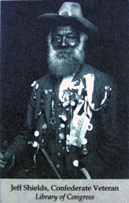
When Robert E. Lee’s army marched into Gettysburg, PA and when the Confederate Army of Tennessee defended Atlanta, the troops were not all white. Thousands of blacks, free and slave marched with the Armies as servants, nurses, surgeon’s assistants, musicians, laborers, teamsters and many in combat roles. Black southerners were an important, integral part of the Confederate Army and Navy. On the home front, black men provided much of the infrastructure for the southern war effort. They staffed hospitals, weapons manufacturing plants in Virginia and Georgia and harvested crops. By February 1865, 310 out of 400 workers at the naval ordnance works in Selma, Alabama were black.
Edward Weeks, a free man of color was a crewman aboard the Confederate commerce raider Shenandoah and was one of the last Confederate service-man of any color to cease fighting in November 1865.
Dr. Lewis Steiner, Chief Inspector of the United States Sanitary Commission while observing Gen. “Stonewall” Jackson’s occupation of Frederick, Maryland in 1862, wrote in a letter, “Over 3,000 Negroes must be included in this number. These were clad in all kinds of uniforms, not only in cast-off or captured United States uniforms, but in coats with Southern buttons, State buttons etc,---Most of the Negroes had arms, rifles, muskets, sabers, Bowie-knives, dirks,.. and were manifestly and integral portion of the Confederate Army.”
Examples of some blacks imprisoned here at Point Lookout include:
Private Charles and Henry Dempsey (2nd N.C. Artillery)
Private J. Doyle (3rd N. C. Artillery)
Daniel Herring Cook (2nd N.C. Artillery)
Private Dick Poplar (13th V.A. Cavalry)
Joe Yerby (Blockade runner)
Two-Thirds of Confederate soldiers were small farmers before the war, the other third was composed of men from more than 100 different prewar occupations. The vast majority of Confederate soldiers, more than 90 percent, did not own slaves or large tracts of land, and would not say that the preservation of slavery was their reason for volunteering to serve in the Confederate army.
Historical Marker
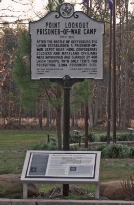
Point Lookout, also known as Camp Hoffman, imprisoned the largest number of military and civilians during the War Between the States. There are 52,264 documented Confederate prisoners at Point Lookout compared to 45,000 imprisoned at the Andersonville prison for Union soldiers.
It is unknown exactly how many prisoners died at the Point Lookout POW camp. There are 3,384 names of dead prisoners listed on the nearby Federal Monument. Yet, nearly 700 additional dead have been identified since then and new names are documented every year.
A historical marker was originally placed in 1963 at the site of the prison pen approximately two miles south of this point. It was stolen in 1995 and seven years later discovered at a salvage yard in Kingston County, New York by a descendent of a Point Lookout prisoner. Despite efforts of the St. Mary’s Historical Society and Maryland State Police, it could not be removed until 2004 when local attorney Earnest Bell Esq. worked with St. Mary’s County and New York State Sheriffs’ offices to return the historical marker to the St. Mary’s Historical Society.
The St. Mary’s Historical Society donated the marker to Confederate Memorial Park and Point Lookout Prisoner of War Descendents Organization in August 2007.
Erected 2008.
Topics. This historical marker is listed in this topic list: War, US Civil. A significant historical month for this entry is February 1865.
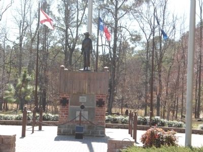
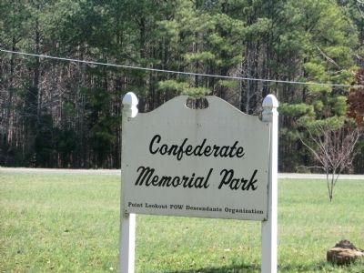
Location. 38° 4.41′ N, 76° 20.436′ W. Marker is in Scotland, Maryland, in St. Mary's County. Marker is on Maryland Route 5. Marker is located in Confederate Memorial Park. Touch for map. Marker is in this post office area: Scotland MD 20687, United States of America. Touch for directions.
Other nearby markers. At least 8 other markers are within 2 miles of this marker, measured
Photographed By Allen C. Browne, January 15, 2012
5. Historical Marker
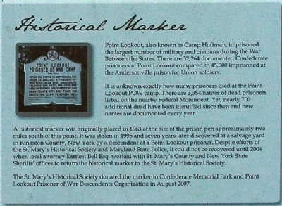
Point Lookout, also known as Camp Hoffman, imprisoned the largest number of military and civilians during the War Between the States. There are 52,264 documented Confederate prisoners at Point Lookout compared to 45,000 imprisoned at the Andersonville prison for Union soldiers.
It is unknown exactly how many prisoners died at the Point Lookout POW camp There are 3,384 names of dead prisoners listed on the nearby Federal Monument. Yet, nearly 700 additional dead have been identified since then and new names are documented every year.
A historical marker was originally placed in 1963 at the site of the prison pen approximately two miles south of this point. It was stolen in 1995 and seven years later discovered at a salvage yard in Kingston County, New York by a descendent of a Point Lookout prisoner. Despite efforts of the St. Mary’s Historical Society and Maryland State Police, it could not be removed until 2004 when local attorney Earnest Bell Esq. worked with St. Mary’s County and New York State Sheriffs’ offices to return the historical marker to the St. Mary’s Historical Society.
The St. Mary’ Historical Society donated the marker to Confederate Memorial Park and Point Lookout Prisoner of War Descendents Organization in August 2007.
Close-up of sidebar on marker
It is unknown exactly how many prisoners died at the Point Lookout POW camp There are 3,384 names of dead prisoners listed on the nearby Federal Monument. Yet, nearly 700 additional dead have been identified since then and new names are documented every year.
A historical marker was originally placed in 1963 at the site of the prison pen approximately two miles south of this point. It was stolen in 1995 and seven years later discovered at a salvage yard in Kingston County, New York by a descendent of a Point Lookout prisoner. Despite efforts of the St. Mary’s Historical Society and Maryland State Police, it could not be removed until 2004 when local attorney Earnest Bell Esq. worked with St. Mary’s County and New York State Sheriffs’ offices to return the historical marker to the St. Mary’s Historical Society.
The St. Mary’ Historical Society donated the marker to Confederate Memorial Park and Point Lookout Prisoner of War Descendents Organization in August 2007.
Credits. This page was last revised on March 18, 2021. It was originally submitted on October 13, 2012, by Don Morfe of Baltimore, Maryland. This page has been viewed 1,019 times since then and 21 times this year. Last updated on March 17, 2021, by Carl Gordon Moore Jr. of North East, Maryland. Photos: 1, 2, 3, 4. submitted on October 13, 2012, by Don Morfe of Baltimore, Maryland. 5, 6, 7. submitted on May 3, 2013, by Allen C. Browne of Silver Spring, Maryland. • Bill Pfingsten was the editor who published this page.
