Near Sharpsburg in Washington County, Maryland — The American Northeast (Mid-Atlantic)
Batteries A and C 4th U.S. Artillery
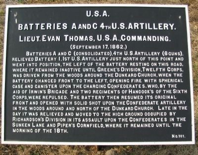
Batteries A and C 4th U.S. Artillery.
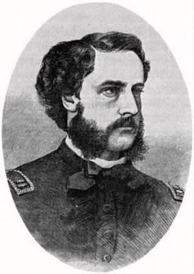
Lieut. Evan Thomas, U.S.A., Commanding.
(September 17, 1862.)
Batteries A and C (consolidated), 4th U.S. Artillery (6 guns), relieved Battery I, 1st U.S. Artillery just north of this point and went into position, the left of the battery resting on this road, where it remained inactive until Greene's Division, Twelfth Corps was driven from the woods around the Dunkard Church, when the battery changed front to the left, opening fire with spherical case and canister upon the charging Confederates, who, by the aid of Irwin's Brigade and two regiments of Hancock's of the Sixth Corps, were repulsed. The Battery then resumed its original front and opened with solid shot upon the Confederate artillery in the woods around and north of the Dunkard Church. Late in the day it was relieved and moved to the high ground occupied by Richardson's Division in its assault upon the Confederates in the Sunken Lane and Piper's Cornfield, where it remained until the morning of the 18th.
Erected by Antietam Battlefield Board. (Marker Number 101.)
Topics and series. This historical marker is listed in this topic list: War, US Civil. In addition, it is included in the Antietam Campaign War Department Markers series list. A significant historical date for this entry is September 17, 1862.
Location. 39° 28.744′ N, 77° 44.604′ W. Marker is near Sharpsburg, Maryland, in Washington County. Marker is on Smoketown Road, on the right when traveling west. Touch for map. Marker is in this post office area: Sharpsburg MD 21782, United States of America. Touch for directions.
Other nearby markers. At least 10 other markers are within walking distance of this marker. Battery I, 1st U.S. Artillery (here, next to this marker); Battery D, 2d U.S. Artillery (a few steps from this marker); Jackson's Command (within shouting distance of this marker); Battery F, 5th U.S. Artillery (within shouting distance of this marker); Battery A (within shouting distance of this marker); Woolfolk’s (Ashland) Virginia Battery (within shouting distance of this marker); Hexamer's (New Jersey) Battery (within shouting distance of this marker); Smith's Division, Sixth Army Corps (within shouting distance of this marker); Sixth Army Corps (about 300 feet away, measured in a direct line); First New Jersey Brigade (about 300 feet away). Touch for a list and map of all markers in Sharpsburg.
Also see . . . Antietam Battlefield. National Park Service site. (Submitted on March 8, 2008, by Craig Swain of Leesburg, Virginia.)
Photographed By Craig Swain, September 17, 2007
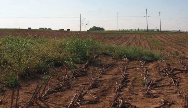
6. Battery Location
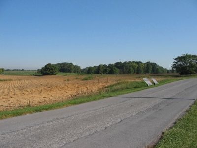
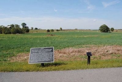
Battery I, 1st U.S. and later the consolidated Batteries A and C, 4th U.S. Artillery occupied positions on the north side of the Smoketown Road. The view here is from the field to the north of the marker location, looking at the high ground along the Smoketown Road where the batteries were in action against Confederates to the west near the Dunker Church. The markers for the two batteries stand in the center distance of the photo near the utility poles.
NOTE: The location from which this photo was taken is private property (although bounded on all sides by Park ground). The Park Service periodically gains permission from the owner to conduct guided tours through this area.
NOTE: The location from which this photo was taken is private property (although bounded on all sides by Park ground). The Park Service periodically gains permission from the owner to conduct guided tours through this area.
Credits. This page was last revised on September 22, 2017. It was originally submitted on March 8, 2008, by Craig Swain of Leesburg, Virginia. This page has been viewed 1,033 times since then and 14 times this year. Photos: 1. submitted on March 8, 2008, by Craig Swain of Leesburg, Virginia. 2. submitted on October 24, 2015, by Brian Scott of Anderson, South Carolina. 3. submitted on March 7, 2008, by Craig Swain of Leesburg, Virginia. 4, 5. submitted on October 24, 2015, by Brian Scott of Anderson, South Carolina. 6. submitted on March 8, 2008, by Craig Swain of Leesburg, Virginia.
