Near Birch River in Nicholas County, West Virginia — The American South (Appalachia)
Young's Monument
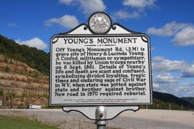
Photographed by Byron Hooks, September 23, 2012
1. Young's Monument Marker
Erected 2008 by Nicholas Co. Historic landmark Commission and Historical & Genealogical Society, West Virginia Division of Archives and History.
Topics and series. This historical marker and monument is listed in this topic list: War, US Civil. In addition, it is included in the West Virginia Archives and History series list. A significant historical date for this entry is September 8, 1861.
Location. 38° 27.796′ N, 80° 46.967′ W. Marker is near Birch River, West Virginia, in Nicholas County. It is on U.S. 19, on the right when traveling north. The marker is located in a parking area along the east side of US 19. Touch for map. Marker is in this post office area: Birch River WV 26610, United States of America. Touch for directions.

Regionally,
this page online
Other nearby markers. At least 8 other markers are within 14 miles of this marker, measured as the crow flies: Nicholas County / Braxton County (approx. 6.3 miles away); Stroud Massacre (approx. 11.2 miles away); Black's Chapel Memorial Church (approx. 11.4 miles away); Webster County / Nicholas County (approx. 11½ miles away); Geographic Center (approx. 11.8 miles away); America's Guard of Honor (approx. 12.6 miles away); Nicholas County Bank (approx. 13.1 miles away); The George C. Bell Post No. 6106 Veterans Memorial (approx. 13.1 miles away).
Another marker is no longer nearby. Nancy Hart (was approx. 13.1 miles away but has been replaced with another marker now near it).
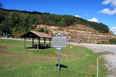
Photographed by Byron Hooks, September 23, 2012
2. Young's Monument Marker and pullout
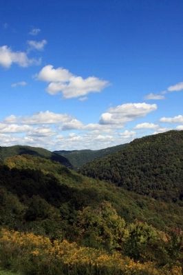
Photographed by Byron Hooks, September 23, 2012
3. Scenic View
Credits. This page was last revised on June 16, 2016. It was originally submitted on October 17, 2012, by Byron Hooks of Sandy Springs, Georgia. This page has been viewed 2,333 times since then and 126 times this year. Photos: 1, 2, 3. submitted on October 17, 2012, by Byron Hooks of Sandy Springs, Georgia. • Craig Swain was the editor who published this page.
