Near Chilocco Indian School in Kay County, Oklahoma — The American South (West South Central)
Oklahoma, The Indian State
Photographed by William Fischer, Jr., October 24, 2011
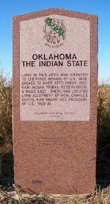
1. Oklahoma, The Indian State Marker
Land in this area was granted to Cherokee Indians by U.S., 1828. Opened to White settlement, 1893. Kaw Indian Tribal Reservation, 5 miles east. There was located land allotment of Hon. Charles Curtis, Kaw Indian, Vice President of U.S., 1928-32.
Erected 1995 by Oklahoma Historical Society. (Marker Number 34.)
Topics and series. This historical marker is listed in these topic lists: Government & Politics • Indigenous Peoples and Communities • Settlements & Settlers. In addition, it is included in the Oklahoma Historical Society series list. A significant historical year for this entry is 1828.
Location. 36° 59.901′ N, 97° 2.746′ W. Marker is near Chilocco Indian School, Oklahoma, in Kay County. It is at the intersection of U.S. 77 and State Line Road, on the right when traveling south on U.S. 77. Marker is at a roadside pullout along the southbound lanes of US Highway 77, just south of the Kansas-Oklahoma state line. Touch for map. Marker is in this post office area: Newkirk OK 74647, United States of America. Touch for directions.

Regionally, this marker is in Northwest Oklahoma — Red Carpet Country. It is also in the American South, specifically on the prairies, and on the Southern Plains. Globally, it is in North America, the Western Hemisphere, the Western World, and the Anglosphere. Historically, it finds itself in what was once the territory of the Mississippian Culture, the Louisiana Purchase, and Cherokee Outlet.
Other nearby markers. At least 8 other markers are within 5 miles of this marker, measured as the crow flies: The Cherokee Strip (here, next to this marker); Chilocco Indian School (here, next to this marker); a different marker also named Cherokee Strip (approx. 0.8 miles away); Cherokee Outlet (approx. 2 miles away in Kansas); a different marker also named The Cherokee Strip
this page online
Also see . . .
1. Oklahoma Historical Society. (Submitted on October 22, 2012, by William Fischer, Jr. of Reynoldsburg, Ohio.)
2. Charles Curtis, Vice President, 1928-1932. (Submitted on October 22, 2012, by William Fischer, Jr. of Reynoldsburg, Ohio.)
Photographed by William Fischer, Jr., October 24, 2011
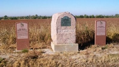
2. Chilocco Indian School, Cherokee Strip DAR, and Oklahoma, The Indian State Markers
Photographed by William Fischer, Jr.
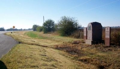
3. The Oklahoma, Cherokee Strip, & Chilocco Indian School Markers
Credits. This page was last revised on June 16, 2016. It was originally submitted on October 22, 2012, by William Fischer, Jr. of Reynoldsburg, Ohio. This page has been viewed 742 times since then and 27 times this year. Photos: 1, 2, 3. submitted on October 22, 2012, by William Fischer, Jr. of Reynoldsburg, Ohio.
