Mannboro in Amelia County, Virginia — The American South (Mid-Atlantic)
Namozine Church
Pursuit Cathces Up
— Lee’s Retreat —
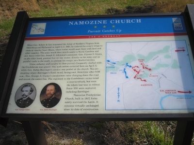
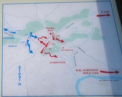
Union infantry and cavalry in close pursuit frequently clashed with the Confederate rear guard. One such action occurred here on April 3, while Gen. Rufus Barringer’s cavalry was posted at the church. You are standing where Barringer’s flank stood, facing east. Sometime after 9:00 a.m., Gen. George A. Custer’s cavalrymen came charging down the road and struck the entire line. The regiment in the Confederate center tried a counterattack, but soon the whole line was in retreat. Some 350 were captured, including Barringer.
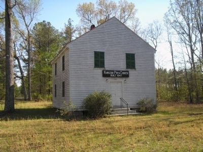
Namozine Presbyterian Church, built in 1847, fortunately survived the battle. It remains virtually unchanged since its date of construction.
Erected by Virginia Civil War Trails.
Topics and series. This historical marker is listed in these topic lists: Churches & Religion • War, US Civil. In addition, it is included in the Virginia Civil War Trails series list. A significant historical month for this entry is April 1790.
Location. 37° 14.956′ N, 77° 43.523′ W. Marker is in Mannboro, Virginia, in Amelia County. Marker is at the intersection of Mill Quarter Road (County Route 622) and Namozine Road (Route 708), on the left when traveling north on Mill Quarter Road. Touch for map. Marker is in this post office area: Mannboro VA 23105, United States of America. Touch for directions.
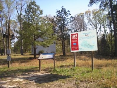
Other nearby markers. At least 8 other markers are within 9 miles of this marker, measured as the crow flies. A different marker also named Namozine Church (here, next to this marker); Lee’s Retreat (here, next to this marker); William Ransom Johnson (approx. 5.2 miles away); Eppington (approx. 5˝ miles away); Battle of Five Forks (approx. 6˝ miles away); Ford's Depot (approx. 6.9 miles away); Piney Grove Church Meeting Site (approx. 7.6 miles away); Clover Hill Mining District (approx. 8.2 miles away). Touch for a list and map of all markers in Mannboro.
More about this marker. The marker features a battle map on the right, and photos of Union Gen. George Custer and Confederate Gen. Rufus Barringer on the bottom left.
Also see . . .
1. Lee's Retreat to Appomattox. Civil War Traveler tour guide. (Submitted on March 8, 2008, by Bill Coughlin of Woodland Park, New Jersey.)
2. Lee's Retreat. Virginia's Retreat tour guide. (Submitted on March 8, 2008, by Bill Coughlin of Woodland Park, New Jersey.)
Credits. This page was last revised on June 16, 2016. It was originally submitted on March 8, 2008, by Bill Coughlin of Woodland Park, New Jersey. This page has been viewed 3,141 times since then and 82 times this year. Photos: 1, 2, 3, 4. submitted on March 8, 2008, by Bill Coughlin of Woodland Park, New Jersey. • Craig Swain was the editor who published this page.


