Near Waynesboro in Burke County, Georgia — The American South (South Atlantic)
Skirmish at Rocky Creek Church
Inscription.
Dec. 2, 1864. Baird's Division, 14th Corps [US], marching on the left of Gen. Sherman’s army in support of Kilpatrick’s cavalry division, which was enroute to burn the bridges over Brier Creek, NE of Waynesboro, reached Rocky Creek about 10:00 A.M. after skirmishing steadily with elements of Wheeler’s cavalry [CS] for several miles. Here near the church Baird found Wheeler posted on the east bank.
The 74th Indiana Infantry attacked across the creek while other units crossed upstream and flanked out the defenders, who then fell back slowly to protect Waynesboro.
Erected by Georgia Historical Commission. (Marker Number 017-13.)
Topics and series. This historical marker is listed in this topic list: War, US Civil. In addition, it is included in the Georgia Historical Society, and the Sherman’s March to the Sea series lists. A significant historical date for this entry is December 2, 1882.
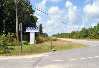
Location. Marker has been reported missing. It was located near 33° 3.822′ N, 82° 5.752′ W. Marker was near Waynesboro, Georgia, in Burke County. Marker was at the intersection of Georgia Route 24 and Rocky Creek Church Road, on the left when traveling west on State Route 24. Touch for map. Marker was in this post office area: Waynesboro GA 30830, United States of America. Touch for directions.
Other nearby markers. At least 8 other markers are within 5 miles of this location, measured as the crow flies. Skirmish at Ivanhoe Plantation (approx. 4.6 miles away); Ivanhoe Plantation (approx. 4.6 miles away); The Shadows (approx. 4.8 miles away); Shell Bluff (approx. 5 miles away); Lost Burke County Men S.S. Otranto (approx. 5 miles away); To Honor George Washington (approx. 5 miles away); Burke County's 8 Governors (approx. 5 miles away); Washington’s Southern Tour (approx. 5 miles away). Touch for a list and map of all markers in Waynesboro.
More about this marker. The marker was observed standing in 2005.
The text for the missing marker was taken from Georgia Historical Markers (Bay Tree Grove, Second Edition 1978) compiled by Carroll P. Scruggs from the records of the Georgia Historical Commission.
Credits. This page was last revised on June 16, 2016. It was originally submitted on October 23, 2012, by David Seibert of Sandy Springs, Georgia. This page has been viewed 871 times since then and 23 times this year. Photo 1. submitted on October 23, 2012, by David Seibert of Sandy Springs, Georgia. • Craig Swain was the editor who published this page.
Editor’s want-list for this marker. Photo of missing marker, prior to disappearance? • Can you help?
