Near Talking Rock in Pickens County, Georgia — The American South (South Atlantic)
Old Federal Road
Photographed by David Seibert, October 11, 2012
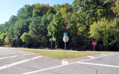
1. Old Federal Road Marker Site
Looking south at the triangle where the marker stood, with Old Georgia Highway 5 to the left, and Georgia Highway 136 to the right.
This location on the old thoroughfare was a Cherokee settlement known as Sanderstown. It was an early post office and the site of Carmel or Taloney Station, a missionary establishment founded here among the Cherokees in 1821.
Erected 1954 by Georgia Historical Commission. (Marker Number 112-3A.)
Topics and series. This historical marker is listed in these topic lists: Indigenous Peoples and Communities • Roads & Vehicles. In addition, it is included in the Georgia Historical Society series list. A significant historical year for this entry is 1803.
Location. Marker has been reported missing. It was located near 34° 31.183′ N, 84° 31.4′ W. Marker was near Talking Rock, Georgia, in Pickens County. It was at the intersection of Ellijay Road (Old Georgia Route 5) and Route 136, in the median
this page online

Regionally, this marker was in the Mountains. It was also in the American South, specifically in the Deep South, in Appalachia, and specifically in Southern Appalachia. Globally, it was in North America, the Western Hemisphere, the Western World, and the Anglosphere. Historically, it found itself in what was once the original Cherokee Nation, the territory of the Mississippian Culture, one of the original Thirteen Colonies, one of the Confederate States of America, and the Antebellum South.
Other nearby markers. At least 8 other markers are within 7 miles of this location, measured as the crow flies: Site of Carmel (Taloney) Mission Station (within shouting distance of this marker); The Zell Miller Mountain Parkway (approx. 1.6 miles away); The Kirby-Quinton Cabin (approx. 6.3 miles away); Oglethorpe Monument (approx. 6.3 miles away); The Old Pickens County Jail (approx. 6.3 miles away); a different marker also named Old Pickens County Jail (approx. 6.3 miles away); Pickens County
Photographed by David Seibert, December 31, 2011
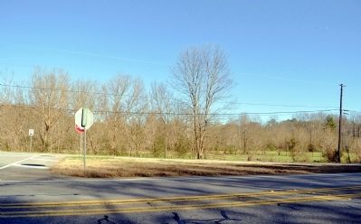
2. Old Federal Road Marker Site
Looking north across Georgia Highway 136 at the site of the marker.
Another marker is no longer nearby. Federal Road Cisca St. Augustine Trail (was approx. 2.7 miles away but has been confirmed missing).
More about this marker. The marker was observed standing in the early 1990s.
The text for the missing marker was taken from Georgia Historical Markers (Bay Tree Grove, Second Edition 1978) compiled by Carroll P. Scruggs from the records of the Georgia Historical Commission.
Credits. This page was last revised on June 16, 2016. It was originally submitted on October 24, 2012, by David Seibert of Sandy Springs, Georgia. This page has been viewed 876 times since then and 46 times this year. Photos: 1, 2. submitted on October 24, 2012, by David Seibert of Sandy Springs, Georgia. • Craig Swain was the editor who published this page.
Editor’s want-list for this marker. Photo of marker before going missing? • Can you help?
