Near Spotsylvania Courthouse in Spotsylvania County, Virginia — The American South (Mid-Atlantic)
Crisis in Tapp Field
Battle of the Wilderness
— Fredericksburg and Spotsylvania National Military Park —
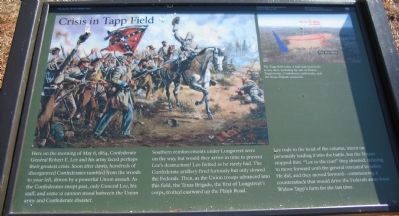
Here on the morning of May 6, 1864, Confederate General Robert E. Lee and his army faced perhaps their greatest crisis. Soon after dawn, hundreds of disorganized Confederates tumbled from the woods to your left, driven by a powerful Union assault. As the Confederates swept past, only General Lee, his staff, and some 12 cannon stood between the Union army and Confederate disaster.
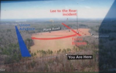
Southern reinforcements under Longstreet were on the way, but would they arrive in time to prevent Lee’s destruction? Lee fretted as he rarely had. The Confederate artillery fired furiously but only slowed the Federals. Then, as the Union troops advanced into this field, the Texas Brigade, the first of Longstreet’s corps, trotted eastward up the Plank Road.
Lee rode to the head of the column, intent on personally leading it into battle, but the Texans stopped him. “Lee to the rear!” they shouted refusing to move forward until the general retreated to safety. He did, and they moved forward – commencing a counterattack that would drive the Federals away.
Erected by National Park Service, U.S. Department of the Interior.
Topics. This historical marker is listed in this topic list: War, US Civil. A significant historical date for this entry is May 6, 1864.
Location. 38° 17.666′ N, 77° 43.485′ W. Marker is near Spotsylvania Courthouse, Virginia, in Spotsylvania County. Marker is on Hill-Ewell Drive, on the right when traveling south. Marker is in the Wilderness Battlefield at Tour Stop 6. Touch for map. Marker is at or near this postal address: 13213 Wilderness Park Dr, Spotsylvania VA 22551, United States of America. Touch for directions.
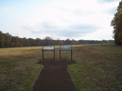
Other nearby markers. At least 8 other markers are within walking distance of this marker. Widow Tapp’s Field (here, next to this marker); Brink of Victory (approx. 0.2 miles away); The Widow Tapp House (approx. 0.2 miles away); The Home of Widow Tapp (approx. 0.2 miles away); Lee to the Rear! (approx. ¼ mile away); Col. James D. Nance (approx. ¼ mile away); Texas (approx. ¼ mile away); Lee to the rear! (approx. ¼ mile away). Touch for a list and map of all markers in Spotsylvania Courthouse.
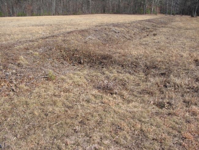
More about this marker. The marker features a large picture of Lee leading his men into battle. The upper right of the marker also has a map of the area with the caption The Tapp field today. A half-mile trail leads to key sites, including the site of Widow Tapp’s house, Confederate earthworks, and the Texas Brigade memorial.
Related markers. Click here for a list of markers that are related to this marker. Wilderness Battlefield - Widow Tapp Fields virtual tour by markers.
Also see . . . General Lee To The Rear!. An account appearing in the Southern Historical Society Papers, from 1 (Submitted on March 8, 2008, by Bill Coughlin of Woodland Park, New Jersey.)
Credits. This page was last revised on July 9, 2021. It was originally submitted on March 8, 2008, by Bill Coughlin of Woodland Park, New Jersey. This page has been viewed 1,628 times since then and 24 times this year. Photos: 1. submitted on March 8, 2008, by Bill Coughlin of Woodland Park, New Jersey. 2. submitted on March 9, 2008, by Craig Swain of Leesburg, Virginia. 3. submitted on March 8, 2008, by Bill Coughlin of Woodland Park, New Jersey. 4. submitted on March 9, 2008, by Craig Swain of Leesburg, Virginia. • Craig Swain was the editor who published this page.


