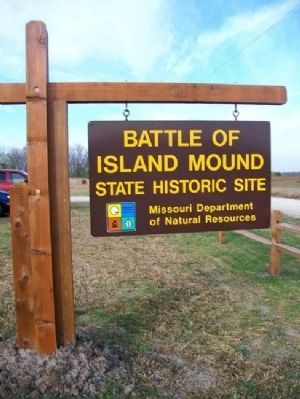
Near Butler in Bates County, Missouri — The American Midwest (Upper Plains)
Bates County, Missouri in 1862
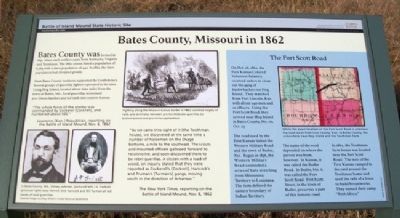
Bates County was formed in 1841. Many early settlers came from Kentucky, Virginia and Tennessee. The 1860 census listed a population of 6,765 with a slave population of 442. In 1862, the slave population had dropped greatly.
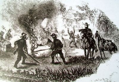
Most Bates County residents supported the Confederacy. Several groups of guerrilla fighters operated in the area. Using Hog Island, located about nine miles from the town of Butler, Mo., local guerrillas terrorized pro-Union families and led raids into eastern Kansas.
"The whole force of the enemy was commanded by Cockerel [Cockrell], and numbered about 500."
Lawrence [Kan.] Republican, reporting on the Battle of Island Mound, Nov. 6, 1862
"As we came into sight of it [the Toothman house], we discovered at the same time a number of horsemen on the Osage bottoms, a mile to the southeast. The scouts and mounted officers galloped forward to reconnoitre, and soon discovered them to be rebel guerillas. A citizen with a load of wood, on inquiry, stated that they were reported as Cockrell's [Cockrell], Hancock's and Truman's [Turman's] gangs, moving south in the direction of Arkansas."
The New York Times, reporting on the Battle of Island Mound, Nov. 8, 1862
The Fort Scott Road
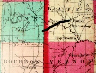
On Oct. 26, 1862 the First Kansas Colored Volunteer Infantry received orders to clean out the gang of bushwhackers on Hog Island. They marched from Fort Lincoln, Kan. with about 240 men and 12 officers. Using the Fort Scott Road, they arrived near Hog Island in Bates County, Mo. on Oct. 27.
The road used by the First Kansas linked the Western Military Road and the town of Butler, Mo. Begun in 1836, the Western Military Road connected a series of forts stretching from Minnesota Territory to Louisiana. The forts defined the eastern boundary of Indian Territory.
The name of the road depended on where the person was from, however. In Kansas, it was called the Butler Road. In Butler, Mo. it was called the Fort Scott Road. Fort Scott Street, in the town of Butler, preserves a part of this historic road.
In 1862, the Toothman farm house was located near the Fort Scott Road. The men of the First Kansas camped in the yard around the Toothman home and used the rails of a fence to build a breastworks. They named their camp "Fort Africa."
Erected 2012 by Missouri Dept. of Natural Resources.
Topics. This historical marker is listed in these topic lists: African Americans • Settlements & Settlers • War, US Civil. A significant historical month for this entry is October 1862.
Location. 38° 14.063′ N, 94° 26.3′ W. Marker is near Butler
, Missouri, in Bates County. Marker can be reached from Marth Road (Road 1002) near Cooper Road (County Road 5001). Marker is on the grounds of Battle of Island Mound State Historic Site. Touch for map. Marker is in this post office area: Butler MO 64730, United States of America. Touch for directions.
Other nearby markers. At least 8 other markers are within 6 miles of this marker, measured as the crow flies. Prairie Fire and the Battle of Island Mound (about 700 feet away, measured in a direct line); The Battle of Island Mound: A Demonstration to the Nation (approx. 0.2 miles away); First Kansas Colored Volunteer Infantry Regimental History (approx. 0.2 miles away); The Battle of Island Mound (approx. 0.2 miles away); Battle of Island Mound Memorial (approx. 0.2 miles away); The Toothman Farm (approx. 0.2 miles away); Replica of the Statue of Liberty (approx. 5.6 miles away); Butler History Murals (approx. 5.9 miles away). Touch for a list and map of all markers in Butler.
Also see . . .
1. The Old Settlers' History of Bates County, Missouri (1900). (Submitted on October 28, 2012, by William Fischer, Jr. of Scranton, Pennsylvania.)
2. The Battle of Island Mound. (Submitted on October 28, 2012, by William Fischer, Jr. of Scranton, Pennsylvania.)
3. First Kansas Colored Infantry. (Submitted on October 28, 2012, by William Fischer, Jr. of Scranton, Pennsylvania.)
4. The Civil War in Missouri. (Submitted on October 28, 2012, by William Fischer, Jr. of Scranton, Pennsylvania.)
5. Battle of Island Mound State Historic Site. (Submitted on October 28, 2012, by William Fischer, Jr. of Scranton, Pennsylvania.)
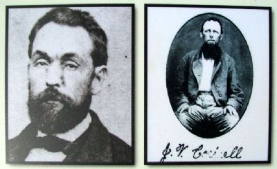
Photographed By Unknown, circa 1850s/60s
4. Photos on Bates County, Missouri in 1862 Marker
[Caption reads] In Bates County, Mo., Sidney Jackman, (pictured left) J.V. Cockrell (pictured right) Jesse Herrell, Dick Hancock and Bill Turman all led bands of local guerrillas. Cockrell image courtesy Wilson's Creek National Battlefield
Credits. This page was last revised on December 15, 2020. It was originally submitted on October 28, 2012, by William Fischer, Jr. of Scranton, Pennsylvania. This page has been viewed 974 times since then and 29 times this year. Photos: 1, 2, 3, 4, 5. submitted on October 28, 2012, by William Fischer, Jr. of Scranton, Pennsylvania. 6. submitted on October 27, 2012, by William Fischer, Jr. of Scranton, Pennsylvania.
