
Windsor in Bertie County, North Carolina — The American South (South Atlantic)
Historic Windsor
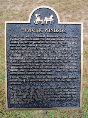
Photographed by Bernard Fisher, October 27, 2012
1. Historic Windsor Marker
Passing through the Historic district one sees stately homes many of which were built in the 18th and 19th centuries.
Windsor has served as the county seat of Bertie County since 1794 when the courthouse and prison were moved by the Assembly from the old town of Cashy. It continues as the county seat and the center of an agricultural and industrial economy based on farm products and the timber industry.
Topics. This historical marker is listed
this page online
Location. 35° 59.64′ N, 76° 56.561′ W. Marker is in Windsor, North Carolina, in Bertie County. It is at the intersection of South King Street and East Water Street (U.S. 17) on South King Street. Touch for map. Marker is in this post office area: Windsor NC 27983, United States of America. Touch for directions.

Regionally, this marker is in North Carolina’s Coastal Plain. It is also in the American South, specifically in the Upper South, in the Tidewater, and on the Eastern Seaboard. Globally, it is in the North Atlantic Region, North America, the Western Hemisphere, the Western World, and the Anglosphere. Historically, it finds itself in what was once the territory of the Mississippian Culture, one of the original Thirteen Colonies, one of the Confederate States of America, and the Antebellum South.
Other nearby markers. At least 8 other markers are within walking distance of this marker: Gray’s Landing (here, next to this marker); The Battle of Windsor (here, next to this marker); Engagement at Windsor
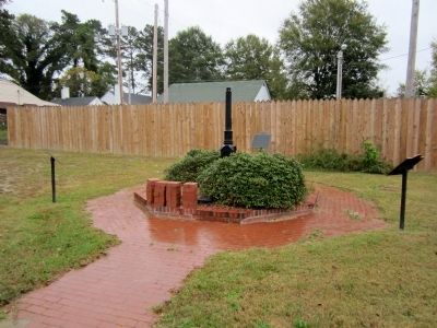
Photographed by Bernard Fisher, October 27, 2012
2. Historic Windsor Marker
Other markers no longer nearby. Engagement at Windsor (was about 700 feet away but has been replaced with another marker now near it); Wellington and Powell Railroad (was approx. 0.2 miles away but has been replaced with another marker now near it).
Credits. This page was last revised on June 16, 2016. It was originally submitted on October 29, 2012, by Bernard Fisher of Richmond, Virginia. This page has been viewed 1,160 times since then and 39 times this year. Photos: 1, 2. submitted on October 29, 2012, by Bernard Fisher of Richmond, Virginia.
