Near Franklin in Southampton County, Virginia — The American South (Mid-Atlantic)
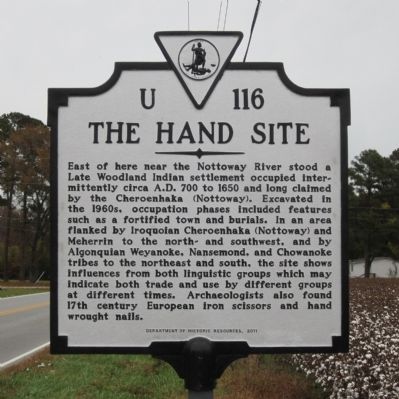
The Hand Site
Erected 2011 by Department of Historic Resources. (Marker Number U-116.)
Topics and series. This historical marker is listed in these topic lists: Anthropology & Archaeology • Native Americans. In addition, it is included in the Virginia Department of Historic Resources (DHR) series list. A significant historical year for this entry is 1650.
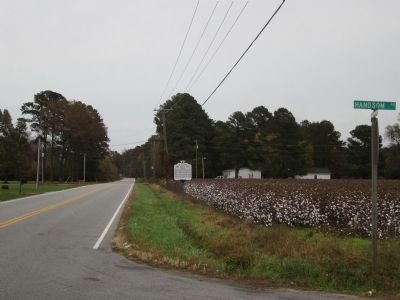
Location. 36° 38.643′ N, 77° 1.826′ W. Marker is near Franklin, Virginia, in Southampton County. Marker is at the intersection of General Thomas Highway (Virginia Route 671) and Handsom Road (Virginia Route 734), on the right when traveling east on General Thomas Highway. Touch for map. Marker is in this post office area: Franklin VA 23851, United States of America. Touch for directions.
Other nearby markers. At least 8 other markers are within 5 miles of this marker, measured as the crow flies. Virginia Native Tribes/First Americans (approx. 3 miles away); General Thomas' Birthplace (approx. 3.2 miles away); "Thomaston" (approx. 3˝ miles away); a different marker also named Thomaston (approx. 3˝ miles away); Marle Hill (approx. 4 miles away); Major Joseph E. Gillette (approx. 4.2 miles away); The Rebecca Vaughan House (approx. 4.9 miles away); William Mahone's Birthplace (approx. 4.9 miles away). Touch for a list and map of all markers in Franklin.
Credits. This page was last revised on June 16, 2016. It was originally submitted on October 29, 2012, by Bernard Fisher of Richmond, Virginia. This page has been viewed 1,464 times since then and 117 times this year. Photos: 1, 2. submitted on October 29, 2012, by Bernard Fisher of Richmond, Virginia.

