Near Woodland in Hertford County, North Carolina — The American South (South Atlantic)
John W. Moore
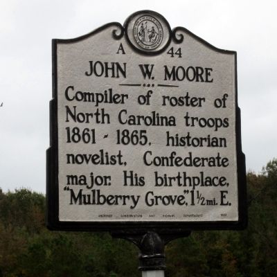
Photographed by Bernard Fisher, October 27, 2012
1. John W. Moore Marker
Erected 1953 by Archives, Conservation and Highway Departments. (Marker Number A-44.)
Topics and series. This historical marker is listed in this topic list: War, US Civil. In addition, it is included in the North Carolina Division of Archives and History series list.
Location. 36° 17.308′ N, 77° 10.824′ W. Marker is near Woodland, North Carolina, in Hertford County. It is at the intersection of State Highway 561 and State Highway 305, on the left when traveling west on State Highway 561. Touch for map. Marker is in this post office area: Woodland NC 27897, United States of America. Touch for directions.

Regionally, this marker is in North Carolina’s Coastal Plain. It is also in the American South, specifically in the Upper South, in the Tidewater, and on the Eastern Seaboard. Globally, it is in the North Atlantic Region, North America, the Western Hemisphere, the Western World, and the Anglosphere. Historically,
this page online
Other nearby markers. At least 8 other markers are within 11 miles of this marker, measured as the crow flies: Rich Square Monthly Meeting (approx. 3½ miles away); Woodland Veterans Memorial (approx. 3½ miles away); Gen. Walter E. Boomer (approx. 5.9 miles away); George V. Holloman (approx. 6.1 miles away); Lemuel Burkitt (approx. 6.4 miles away); Meherrin Tribe (approx. 10.3 miles away); 4-H Club (approx. 10.6 miles away); Robert Lee Van (approx. 10.6 miles away). Touch for a list and map of all markers in Woodland.
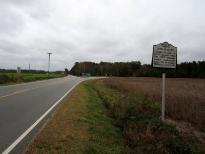
Photographed by Bernard Fisher, October 27, 2012
2. Nc 561 & Nc 305
Credits. This page was last revised on June 30, 2021. It was originally submitted on October 29, 2012, by Bernard Fisher of Richmond, Virginia. This page has been viewed 648 times since then and 19 times this year. Photos: 1, 2. submitted on October 29, 2012, by Bernard Fisher of Richmond, Virginia.
