Cruz Bay in St. John, Virgin Islands — The Caribbean (The West Indies)
Establishment of Virgin Islands National Park
A Grassroots Contribution
Photographed by Don Morfe, January 29, 2012
1. Establishment of Virgin Islands National Park Marker
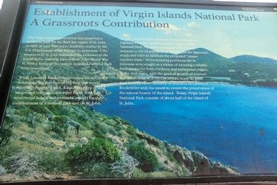
The Virgin Islands government had proposed a territorial park for the Reef Bay region of St. John as early as 1937. This led to feasibility studies by the U.S. Department of the Interior to determine if the resources of St. John warranted the inclusion of the island in the National Park system. After World War II, both a National Recreation Area and National Park were considered.
While Laurance Rockefeller provided the necessary funding for the purchase of the land that would eventually become a park, it was the urging of land owner and real estate developer Frank Stick that resurrected federal and territorial interest for the establishment of a national park unit on St. John.
St. John Senator Julius Sprauve, Sr. introduced local legislation for the establishment of Virgin Islands National Park. He was also integral in Territorial requests to the Department of the Interior for improved roads and trails to facilitate the proposed “winter resident trade.” Homesteading provisions for St. Johnians were sought as a means of ensuring a reliable food source for both residents and anticipated visitors. In the mid-1950’s,
this page online
Erected by National Park Service, U.S. Department of the Interior.
Topics. This historical marker is listed in these topic lists: Landmarks • Parks & Recreational Areas. A significant historical date for this entry is August 2, 1956.
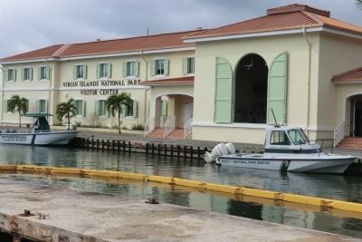
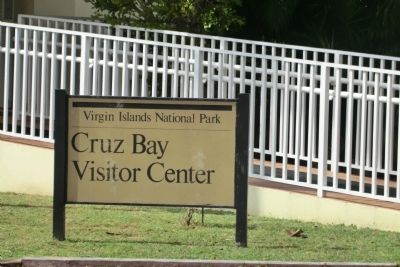
Location. 18° 19.986′ N, 64° 47.586′ W. Marker is in Cruz Bay in St. John, Virgin Islands. It is on North Shore Road. The marker is located on the grounds of the Virgin Island National Park Visitor Center. Touch for map. Marker is in this post office area: St John VI 00831, United States of America. Touch for directions.

Regionally, it is one of the Lesser Antilles on the Caribbean Sea, on in the Atlantic Ocean, in North America, in the Western Hemisphere, in the Western World, and in the Anglosphere.
Other nearby markers. At least 8 other markers are within 5 miles of this marker, measured
Photographed by Don Morfe, January 29, 2012
2. Establishment of Virgin Islands National Park Marker
Other markers no longer nearby. Horse Mill (was approx. 4.6 miles away but has been permanently removed); Annaberg Historic Trail (was approx. 4.6 miles away but has been permanently removed); Slave Quarters (was approx. 4.6 miles away but has been permanently removed).
Photographed by Don Morfe, January 29, 2012
3. Establishment of Virgin Islands National Park Marker
Photographed by Don Morfe, January 29, 2012
4. Establishment of Virgin Islands National Park Marker
Credits. This page was last revised on June 11, 2024. It was originally submitted on October 30, 2012, by Don Morfe of Baltimore, Maryland. This page has been viewed 709 times since then and 23 times this year. Photos: 1, 2, 3, 4. submitted on October 30, 2012, by Don Morfe of Baltimore, Maryland. • Bill Pfingsten was the editor who published this page.
