Sutherland in Dinwiddie County, Virginia — The American South (Mid-Atlantic)
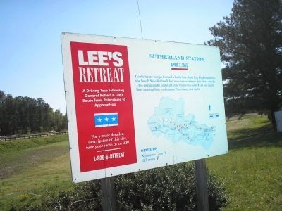
Sutherland Station
Lee's Retreat
— April 2, 1865 —
Inscription.
Confederate troops formed a battle line along Cox Road to protect the South Side Railroad, but were overwhelmed after three attacks. This engagement enabled Grant’s forces to sever Lee’s last supply line, causing him to abandon Petersburg that night.
Next Stop
Namozine Church
10.5 miles
Erected by Virginia's Retreat.
Topics. This historical marker is listed in this topic list: War, US Civil.
Location. 37° 11.818′ N, 77° 33.89′ W. Marker is in Sutherland, Virginia, in Dinwiddie County. Marker is at the intersection of Namozine Road (U.S. 708) and Cox Road (U.S. 460), on the left when traveling north on Namozine Road. Touch for map. Marker is in this post office area: Sutherland VA 23885, United States of America. Touch for directions.
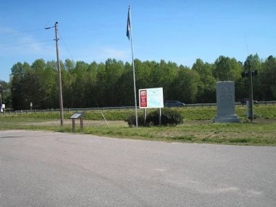
Other nearby markers. At least 8 other markers are within 4 miles of this marker, measured as the crow flies. A different marker also named Sutherland Station (here, next to this marker); The Battle of Sutherland (a few steps from this marker); Fork Inn (about 300 feet away, measured in a direct line); Engagement at Sutherland Station (about 600 feet away); Appomattox Campaign (Sutherland Station) (about 700 feet away); Rocky Branch School (approx. 0.7 miles away); Col. John Banister (approx. 1.2 miles away); The Battle of White Oak Road (approx. 3.2 miles away). Touch for a list and map of all markers in Sutherland.
More about this marker. Below the main text of the marker is a map of the retreat showing important stops along the route.
Regarding Sutherland Station. Part of a driving tour following General Robert E. Lee's route from Petersburg to Appomattox. While visiting the site a more detailed description is played on short range radio on AM1610. Or call 1-800-6-retreat.
Also see . . .
1. Lee’s Retreat. (Submitted on March 12, 2008, by Bill Coughlin of Woodland Park, New Jersey.)
2. Lee's Retreat to Appomattox. Virginia Civil War Trails (Submitted on March 12, 2008, by Bill Coughlin of Woodland Park, New Jersey.)
3. The Battle of Sutherland’s Station. The American Civil War website. (Submitted on January 22, 2009, by Bill Coughlin of Woodland Park, New Jersey.)
Credits. This page was last revised on June 16, 2016. It was originally submitted on March 9, 2008, by Bill Coughlin of Woodland Park, New Jersey. This page has been viewed 1,258 times since then and 14 times this year. Photos: 1, 2. submitted on March 9, 2008, by Bill Coughlin of Woodland Park, New Jersey. • Craig Swain was the editor who published this page.

