Surrey in Greater Vancouver, British Columbia — Canadaís West Coast (North America)
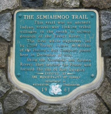
The Semiahmoo Trail
The first white explorers, lead by Chief Trader James McMillan of the Hudsonís Bay Company passed here in December of 1824.
Using the Nicomekl and Salmon Rivers, they reached the Fraser and located the site of Fort Langley. Erected by the This trail was an ancient Indian travel-way linking tribal villages in the south to salmon grounds of the Fraser River. The first white explorers, lead by Chief Trader James McMillan of the Hudsonís Bay Company passed here in December 0f 1824. Using the Nicomekl and Salmon Rivers, they reached the Fraser and located the site of Fort Langley.
Erected 1961 by Municipality of Surrey Department of Recreation Commission.
Topics. This historical marker is listed in this topic list: Roads & Vehicles. A significant historical month for this entry is December 1824.
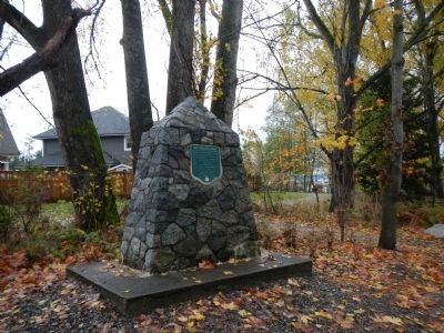
Location. 49° 4.126′ N, 122° 49.537′ W. Marker is in Surrey, British Columbia, in Greater Vancouver. Marker is on Elgin Road, on the right when traveling south. Touch for map. Marker is at or near this postal address: 3653 Elgin Road, Surrey BC V4P 0C2, Canada. Touch for directions.
Other nearby markers. At least 8 other markers are within 16 kilometers of this marker, measured as the crow flies. Historic Port Elgin (within shouting distance of this marker); Historic Elgin (approx. 0.2 kilometers away); Historic Stewart Farmhouse (approx. 1.3 kilometers away); Farming History (approx. 1.3 kilometers away); Historic McMillan Expedition (approx. 4.7 kilometers away); Peace Arch (approx. 9 kilometers away); Salmon! (approx. 13.7 kilometers away); The New Westminster Court House and Land Registry Office (approx. 16.2 kilometers away). Touch for a list and map of all markers in Surrey.
Credits. This page was last revised on August 16, 2017. It was originally submitted on November 3, 2012, by Barry Swackhamer of Brentwood, California. This page has been viewed 671 times since then and 27 times this year. Photos: 1, 2. submitted on November 3, 2012, by Barry Swackhamer of Brentwood, California. • Syd Whittle was the editor who published this page.

