Near Elkmont in Limestone County, Alabama — The American South (East South Central)
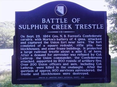
Battle of Sulphur Creek Trestle
Erected 1982 by Limestone County Historical Society.
Topics. This historical marker is listed in these topic lists: Forts and Castles • Railroads & Streetcars • War, US Civil. A significant historical month for this entry is September 1809.
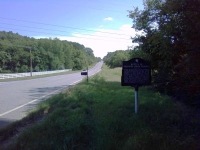
Location. 34° 54.702′ N, 86° 59.308′ W. Marker is near Elkmont, Alabama, in Limestone County. Marker is on Elkmont Road/North Jefferson Street (Alabama Route 127) 1.2 miles south of Morris Road, on the right when traveling south. Touch for map. Marker is at or near this postal address: 24514 Elkmont Rd, Elkmont AL 35620, United States of America. Touch for directions.
Other nearby markers. At least 8 other markers are within 5 miles of this marker, measured as the crow flies. Sulphur Creek Trestle, 1864 (approx. 1˝ miles away); Limestone County's First High School / The Delmore Brothers (approx. 1˝ miles away); Elkmont, Alabama / Tenn. & Ala. Central Railroad (approx. 1˝ miles away); Commerce (approx. 1˝ miles away); Downtown Scenes (approx. 1˝ miles away); Elkmont Pride: Family-School-Church (approx. 1˝ miles away); Old New Garden Cemetery / New Garden Cumberland Presbyterian Church (approx. 1.8 miles away); Alabama Fork Cumberland Presbyterian Church (approx. 4.2 miles away). Touch for a list and map of all markers in Elkmont.
Regarding Battle of Sulphur Creek Trestle. The location of the trestle/battle is accessible on a well-maintained trail (Richard Martin Trail) that follows the path of the former railroad. The closest access point to the marker is from downtown Elkmont near the old train station/historical society building.
The Sulfur Creek Trestle was rebuilt after the war and railroad traffic on the Tennessee and Alabama Central Railway continued until 1986. The rebuilt trestle was eventually filled in with dirt as it exist today. It stands about 60 feet above Sulfur Creek and is about 1000 feet in length. The track and cross ties have been removed and the
surface is covered with fine gravel. It is now used for walking, bicycling, and horse riding as a part of the “Rail to Trails”, which runs from the Tennessee State Line to about 4.3 miles south of the trestle to Piney Chapel Road.
Also see . . . The Encyclopedia of Alabama article on the Battle of Sulphur Trestle. (Submitted on August 15, 2017, by Mark Hilton of Montgomery, Alabama.)
Additional keywords. U.S.C.T.
Credits. This page was last revised on August 26, 2021. It was originally submitted on August 14, 2010, by Lee Hattabaugh of Capshaw, Alabama. This page has been viewed 3,069 times since then and 40 times this year. Last updated on November 5, 2012, by Lee Hattabaugh of Capshaw, Alabama. Photos: 1, 2. submitted on August 14, 2010, by Lee Hattabaugh of Capshaw, Alabama. • Bill Pfingsten was the editor who published this page.

