West Suburb in Lexington in Fayette County, Kentucky — The American South (East South Central)
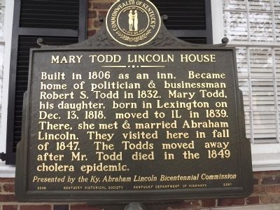
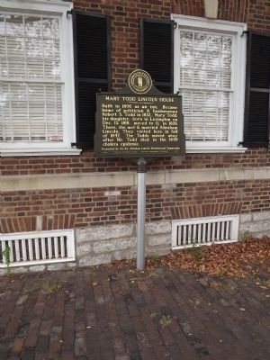
Mary Todd Lincoln House
Presented by the Ky. Abraham Lincoln Bicentennial Commission
Erected 2008 by Kentucky Historical Society, Kentucky Department of Highways. (Marker Number 2261.)
Topics and series. This historical marker is listed in these topic lists: Government & Politics • Settlements & Settlers • Women. In addition, it is included in the Former U.S. Presidents: #16 Abraham Lincoln, and the Kentucky Historical Society series lists. A significant historical month for this entry is December 1917.
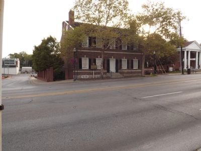
Location. 38° 3.077′ N, 84° 30.162′ W. Marker is in Lexington, Kentucky, in Fayette County. It is in West Suburb. Marker is at the intersection of West Main Street (U.S. 25, 421) and Tucker Street, on the left when traveling west on West Main Street. Touch for map. Marker is at or near this postal address: 578 West Main Street, Lexington KY 40507, United States of America. Touch for directions.
Other nearby markers. At least 8 other markers are within walking distance of this marker. Todd House (within shouting distance of this marker); Pioneer Burying Ground (about 500 feet away, measured in a direct line); Town Branch (about 600 feet away); Vertner Woodson Tandy (about 700 feet away); Mary Todd Lincoln (approx. 0.2 miles away); St. Paul Catholic Church (approx. 0.2 miles away); Lexington (approx. 0.2 miles away); From Enslaved to the Presidency / From Slavery to Liberation (approx. 0.2 miles away). Touch for a list and map of all markers in Lexington.
Also see . . . Mary Todd Lincoln House. (Submitted on November 13, 2012, by Bernard Fisher of Richmond, Virginia.)
Credits. This page was last revised on February 12, 2023. It was originally submitted on November 11, 2012, by Ken Smith of Milan, Tennessee. This page has been viewed 764 times since then and 32 times this year. Photos: 1, 2, 3. submitted on November 11, 2012, by Ken Smith of Milan, Tennessee. • Bernard Fisher was the editor who published this page.


