Union Springs in Bullock County, Alabama — The American South (East South Central)
Indian Treaty Boundary Line
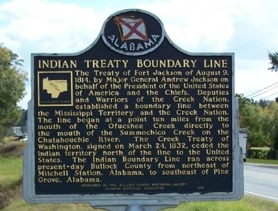
Photographed by David J Gaines, October 25, 2012
1. Indian Treaty Boundary Line Marker
Erected 1998 by The Bullock County Historical Society and the Alabama Historical Association.
Topics and series. This historical marker is listed in this topic list: Indigenous Peoples and Communities. In addition, it is included in the Alabama Historical Association, and the Former U.S. Presidents: #07 Andrew Jackson series lists. A significant historical month for this entry is August 1814.
Location. 32° 7.718′ N, 85° 42.888′ W. Marker is in
this page online

Regionally, this marker is in the American South, specifically in the Deep South, and in the Black Belt. Globally, it is in North America, a Gulf of Mexico state, the Western Hemisphere, the Western World, and the Anglosphere. Historically, it finds itself in what was once the territory of the Mississippian Culture, one of the Confederate States of America, and the Antebellum South.
Other nearby markers. At least 8 other markers are within 2 miles of this marker, measured as the crow flies: A different marker also named Indian Treaty Boundary Line (approx. 0.9 miles away); Trinity Episcopal Church / Red Door Theater (approx. one mile away); Log Cabin Museum / Old City Cemetery (approx. one mile away); Hank Williams (approx. 1.1 miles away); Bullock County Courthouse Historic District (approx. 1.2 miles away); Union Springs, Alabama (approx. 1.2 miles away); Eddie Kendricks (approx. 1.2 miles away); Depot & Coal Shute
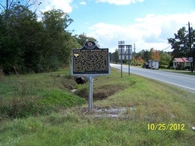
Photographed by David J Gaines, October 25, 2012
2. Indian Treaty Boundary Line Marker
More about this marker. Located S of downtown Union Springs on US-29 near South Prairie St. There is an identical marker west of downtown on US-82.
Credits. This page was last revised on July 18, 2022. It was originally submitted on November 11, 2012, by David J Gaines of Pinson, Alabama. This page has been viewed 1,639 times since then and 96 times this year. Photos: 1, 2. submitted on November 11, 2012, by David J Gaines of Pinson, Alabama. • Bill Pfingsten was the editor who published this page.
