Over the Summit
Lincoln Highway Heritage Corridor
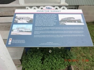
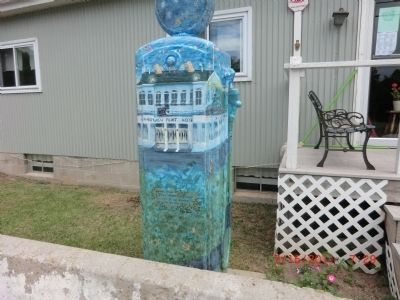
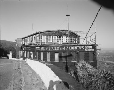
“See 3 states, 7 counties”---For decades this was the slogan that greeted motorists as they climbed the Allegheny Mountain summit and rounded the sharp bend. The S.S. Grand View Point was the brainchild of Herbert Paulson, a Dutch immigrant. He began with a roadside stand and picnic/camping area: then expanded it to resemble a castle with multiple overlooks. The structure was cantilevered under and had 18 steel beams anchoring it. A telescope beckoned visitors to enjoy the 60+ mile view.
Because of his love of the sea, in 1932 Paulson transformed the castle structure into a ship---complete with observation decks, captain’s wheel,
this page online
New owners in the 1970’s attempted unsuccessfully to revive the site calling it Noah’s Ark. For more than twenty years the Ship sat idle and fell into serious disrepair. In the early morning hours of October 26, 2001, the S.S. Grand View Ship Hotel burned to the ground. Today, Lincoln Highway motorists still enjoy the view of “3 states and 7 counties” as they travel over the Allegheny Mountain summit.
Topics and series. This historical marker is listed in this topic list: Roads & Vehicles. In addition, it is included in the Lincoln Highway series list. A significant historical date for this entry is October 26, 1836.
Location. 40° 2.232′ N, 78° 45.516′ W. Marker is near Indian Lake, Pennsylvania, in Bedford County. It is in Juniata Township. It is on Lincoln Highway (U.S. 30). Touch for map. Marker is at

Regionally, this marker is in South-Central Pennsylvania and in the Laurel Highlands. It is also in the American Northeast, in the Mid-Atlantic, in Appalachia, and specifically in Northern Appalachia. Globally, it is in North America, the Western Hemisphere, the Western World, and the Anglosphere. Historically, it finds itself in what was once the Haudenosaunee (Iroquois) Confederacy and also one of the original Thirteen Colonies.
Other nearby markers. At least 8 other markers are within 6 miles of this marker, measured as the crow flies: Forbes Road (approx. half a mile away); Jacob Kinsey (Kintzy) Homestead (approx. 2.1 miles away); Somerset County Bridge No. 5 • New Baltimore Covered Bridge (approx. 3.6 miles away); New Baltimore Veterans Memorial (approx. 3.6 miles away); Lincoln Highway Heritage Corridor (approx. 4.1 miles away); 1806 Old Log Church (approx. 5½ miles away); Bedford Co. Bridge #15 (approx. 5½ miles away); Old Log Church (approx. 5½ miles away).
Another marker is no longer nearby.
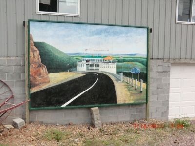
Also see . . . Historic American Buildings Survey record for the S.S. Grand View Point Hotel. (Submitted on November 22, 2012.)
Credits. This page was last revised on February 7, 2023. It was originally submitted on November 15, 2012, by Don Morfe of Baltimore, Maryland. This page has been viewed 1,059 times since then and 35 times this year. Photos: 1, 2, 3. submitted on November 15, 2012, by Don Morfe of Baltimore, Maryland. 4. submitted on November 22, 2012. • Bill Pfingsten was the editor who published this page.
