Near Locust Grove in Orange County, Virginia — The American South (Mid-Atlantic)
Ellwood
The Battle of the Wilderness
— Fredericksburg and Spotsylvania National Military Park —
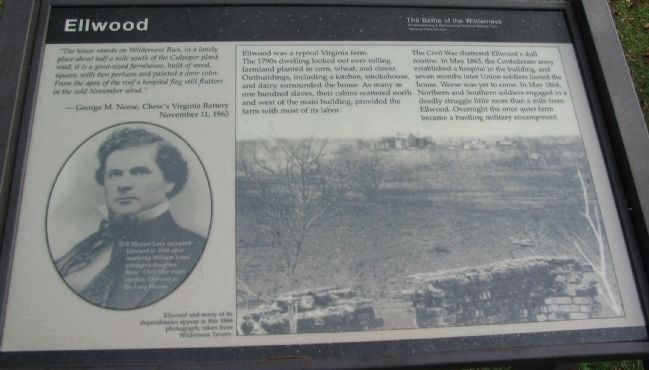
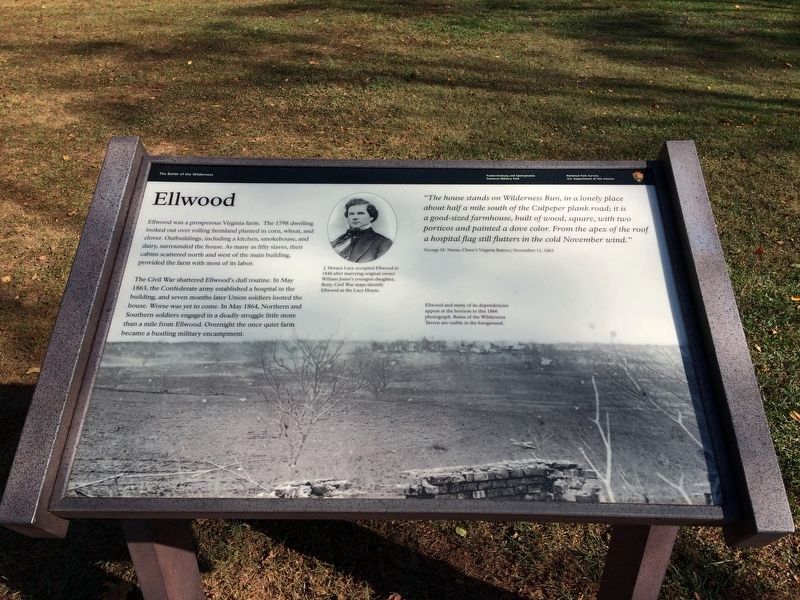
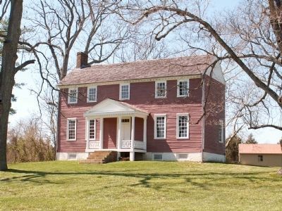
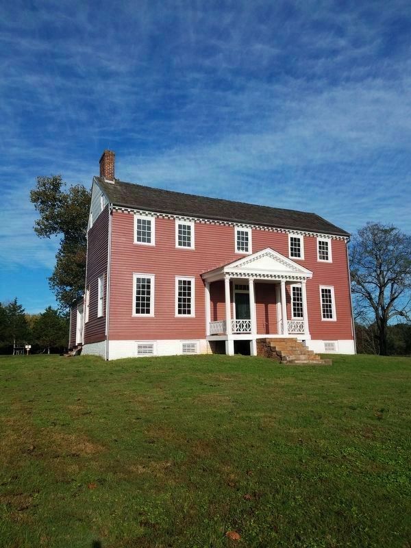
“The house stands on Wilderness Run, in a lonely place about half a mile south of the Culpeper plank road; it is a good-sized farmhouse, built of wood, square, with two porticos and painted a dove color. From the apex of the roof a hospital flag still flutters in the cold November wind.”
- George M. Neese, Chew’s Virginia Battery November 11, 1863
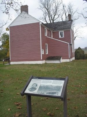
Ellwood was a typical Virginia farm. The 1790s dwelling looked out over rolling farmland planted in corn, wheat, and clover. Outbuildings, including a kitchen, smokehouse, and dairy, surrounded the house. As many as one hundred slaves, their cabins scattered north and west of the main building, provided the farm with most of its labor.
The Civil War shattered Ellwood’s dull routine. In May 1863, the Confederate army established a hospital in the building, and seven months later Union soldiers looted the house. Worse was yet to come. In May 1864, Northern and Southern soldiers engaged in a deadly struggle little more than a mile from Ellwood. Overnight the once quiet farm became a bustling military encampment.
Erected by National Park Service, U.S. Department of the Interior.
Topics. This historical marker is listed in this topic list: War, US Civil. A significant historical month for this entry is May 1863.
Location. 38° 19.162′ N, 77° 43.904′ W. Marker is near Locust Grove, Virginia, in Orange County. Marker can be reached from Constitution Highway (Virginia Route 20), on the left when traveling west. Located at the Ellwood (Lacy House) section of the Wilderness Battlefield, within the Fredericksburg-Spotsylvania National Military Park. Touch for map. Marker is in this post office area: Locust Grove VA 22508, United States of America. Touch for directions.
Other nearby markers. At least 8 other markers are within walking distance of this marker. Archeology at Ellwood (here, next to this marker); A Busy Place (within shouting distance of this marker); The Yard: A Busy Place (within shouting distance of this marker); Union Headquarters (within shouting distance of this marker); a different marker also named Union Headquarters (within shouting distance of this marker); A Military Scene (within shouting distance of this marker); a different marker also named A Military Scene (within shouting distance of this marker); Toil Without Choice at Ellwood (within shouting distance of this marker). Touch for a list and map of all markers in Locust Grove.
More about this marker. The left of the marker features a picture of J. Horace Lacy with the caption J.Horace Lacey in 1848 after marrying William Jones’ youngest daughter, Betty. Civil War maps identify Ellwood as the Lacy House.
The right portion of the marker contains a picture with
the caption Ellwood and many of its dependencies appear in this 1866 photograph taken from Wilderness Tavern.
Also see . . .
1. Ellwood Manor. National Park Service website entry (Submitted on March 11, 2008, by Bill Coughlin of Woodland Park, New Jersey.)
2. Battle of the Wilderness. Wikipedia entry (Submitted on November 23, 2022, by Larry Gertner of New York, New York.)
Additional commentary.
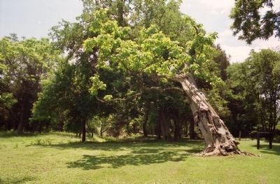
1. The Ellwood Catalpa
A famous giant catalpa tree stood with a precarious lean behind the Ellwood house for 170 years. It witnessed the building of the house and battles fought nearby during the Civil War. It blew down in a storm on the night of September 14, 2006. Note To Editor only visible by Contributor and editor
— Submitted June 26, 2011, by David Graff of Halifax, Nova Scotia.
Credits. This page was last revised on November 23, 2022. It was originally submitted on March 11, 2008, by Bill Coughlin of Woodland Park, New Jersey. This page has been viewed 2,255 times since then and 18 times this year. Photos: 1. submitted on October 23, 2008, by Craig Swain of Leesburg, Virginia. 2. submitted on January 5, 2018, by Shane Oliver of Richmond, Virginia. 3, 4. submitted on March 11, 2008, by Bill Coughlin of Woodland Park, New Jersey. 5. submitted on March 12, 2008, by Bryan Olson of Syracuse, New York. 6. submitted on March 7, 2020, by Bradley Owen of Morgantown, West Virginia. 7. submitted on June 26, 2011, by David Graff of Halifax, Nova Scotia. • Craig Swain was the editor who published this page.
