
Near Port Lavaca in Calhoun County, Texas — The American South (West South Central)
Green Lake
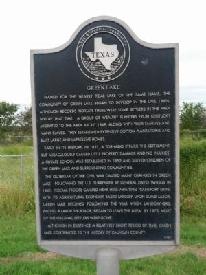
Photographed by Gregory Walker, October 18, 2012
1. Green Lake Marker
Early in its history, in 1851, a tornado struck the settlement, but miraculously caused little property damage and no injuries. A private school was established in 1852 and served children of the Green Lake and surrounding communities.
The outbreak of the Civil War caused many changes in Green Lake. Following the U.S. surrender by General David Twiggs in 1861, Federal troops camped near here awaiting transport ships. With its agricultural economy based largely upon slave labor, Green Lake declined following the war when landowners, facing a labor shortage, began to leave the area. By 1875, most of the original settlers were gone.
Although in existence a relatively short period of time, Green Lake contributed to the history
this page online
Erected 1988 by Texas Historical Commission. (Marker Number 2268.)
Topics. This historical marker is listed in these topic lists: Settlements & Settlers • War, US Civil. A significant historical year for this entry is 1849.
Location. 28° 31.503′ N, 96° 47.645′ W. Marker is near Port Lavaca, Texas, in Calhoun County. It is at the intersection of State Highway 35 and State Highway 185, on the right when traveling west on State Highway 35. Touch for map. Marker is in this post office area: Port Lavaca TX 77979, United States of America. Touch for directions.

Regionally, this marker is in the American South and on the Gulf Coast. Globally, it is in North America, a Gulf of Mexico state, the Western Hemisphere, the Western World, and the Anglosphere. Historically, it finds itself in what was once New Spain, the Republic of Texas, and one of the Confederate States of America.
Other nearby markers. At least 8 other markers are within 8 miles of this marker, measured as the crow flies: Original Mission Refugio (approx. 1.4 miles away); Cotton Gins of Calhoun County (approx. 2.3 miles away); Hatch Cemetery
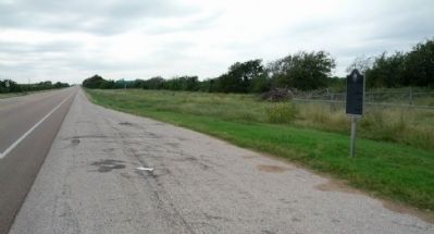
Photographed by Gregory Walker, October 18, 2012
2. Location of Green Lake Marker
Credits. This page was last revised on June 16, 2016. It was originally submitted on November 22, 2012, by Gregory Walker of La Grange, Texas. This page has been viewed 2,290 times since then and 153 times this year. Photos: 1, 2. submitted on November 22, 2012, by Gregory Walker of La Grange, Texas. • Bernard Fisher was the editor who published this page.
