Near Weimar in Colorado County, Texas — The American South (West South Central)
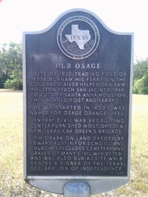
Old Osage
Town started in 1850s was named for Osage Orange trees.
In 1861, Civil War recruiting center. Furnished most of Co. A, 5th Texas Cav., Green's Brigade.
This park, on land deeded by Edward Austin for school and churches, includes cemetery and graves of many Civil War veterans. Was also burial site, Wm. B. Scates, a signer of the Texas Declaration of Independence.
Erected 1965 by State Historical Survey Committee. (Marker Number 3881.)
Topics. This historical marker is listed in these topic lists: Cemeteries & Burial Sites • Settlements & Settlers • War, Texas Independence • War, US Civil. A significant historical year for this entry is 1820.
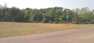
Location. 29° 44.411′ N, 96° 42.993′ W. Marker is near Weimar, Texas, in Colorado County. Marker is at the intersection of County Road 208 and County Road 205, on the left when traveling north on County Road 208. Touch for map. Marker is in this post office area: Weimar TX 78962, United States of America. Touch for directions.
Other nearby markers. At least 8 other markers are within 7 miles of this marker, measured as the crow flies. St. Michael’s Catholic Church (approx. 4˝ miles away); Town of Weimar (approx. 4.6 miles away); Weimar Railroad Depot (approx. 4.7 miles away); Weimar Masonic Lodge No. 423 (approx. 4.7 miles away); The Holman-Seifert Homestead (approx. 4.8 miles away); Weimar Masonic Cemetery (approx. 5.4 miles away); John Pettit Borden (approx. 5.4 miles away); Site of Burnam's Ferry (approx. 6˝ miles away). Touch for a list and map of all markers in Weimar.
Credits. This page was last revised on June 16, 2016. It was originally submitted on November 22, 2012, by Gregory Walker of La Grange, Texas. This page has been viewed 671 times since then and 20 times this year. Photos: 1, 2. submitted on November 22, 2012, by Gregory Walker of La Grange, Texas. • Bernard Fisher was the editor who published this page.

