Marthasville in Warren County, Missouri — The American Midwest (Upper Plains)
La Charrette / Marthasville
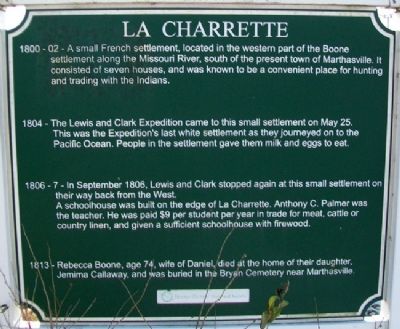
La Charrette
1800-02 - A small French settlement, located in the western part of the Boone settlement along the Missouri River, south of the present town of Marthasville. It consisted of seven houses, and was known to be a convenient place for hunting and trading with the Indians.
1804 - The Lewis and Clark Expedition came to this small settlement on May 25. This was the Expedition's last white settlement as they journeyed on to the Pacific Ocean. People in the settlement gave them milk and eggs to eat.
1806-7 - In September 1806, Lewis and Clark stopped again at this small settlement on their way back from the West. A schoolhouse was built on the edge of La Charrette. Anthony C. Palmer was the teacher. He was paid $9 per student per year in trade for meat, cattle or country linen, and given a sufficient schoolhouse with firewood.
1813 - Rebecca Boone, age 74, wife of Daniel, died at the home of their daughter, Jemima Callaway, and was buried in the Bryan Cemetery near Marthasville.
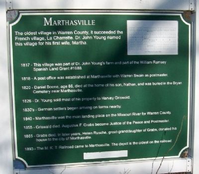
Marthasville
The oldest village in Warren County, it succeeded the French village, La Charrette. Dr. John Young named this village for his first wife, Martha.
1817 - This village was part of Dr. John Young's farm and part of the William Ramsey Spanish Land Grant #1688.
1818 - A post office was established at Marthasville with Warren Swain as postmaster.
1820 - Daniel Boone, age 86, died at the home of his son, Nathan, and was buried in the Bryan Cemetery near Marthasville.
1826 - Dr. Young sold most of his property to Harvey Griswold.
1830's - German settlers began arriving on farms nearby.
1840 - Marthasville was the main landing place on the Missouri River for Warren County.
1855 - Griswald [sic] died. Augustus F. Grabs became Justice of the Peace and Postmaster.
1865 - Grabs died. In later years, Helen Rusche, great-granddaughter of Grabs, donated his house to the city of Marthasville.
1893 - The M. K. T. Railroad came to Marthasville. The depot is the oldest on the railroad.
Erected by Boone-Duden Historical Society.
Topics. This historical marker is listed in these topic lists: Exploration • Settlements & Settlers • Waterways & Vessels. A significant historical month for this entry is May 1804.
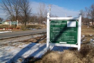
Location. 38° 37.589′ N, 91° 3.615′ W. Marker is in Marthasville, Missouri, in Warren County. Marker is on 1st Street near Missouri Highway 47/94, on the right when traveling north. Marker is in Wessel Park, about 200 feet south of the Katy Trail pathway. Touch for map. Marker is in this post office area: Marthasville MO 63357, United States of America. Touch for directions.
Other nearby markers. At least 8 other markers are within walking distance of this marker. La Charrette (within shouting distance of this marker); The Lewis and Clark Expedition Across Missouri (within shouting distance of this marker); a different marker also named The Lewis and Clark Expedition Across Missouri (about 300 feet away, measured in a direct line); 25th Anniversary (about 300 feet away); History of Marthasville (about 300 feet away); Marthasville to Dutzow (about 300 feet away); Lewis and Clark in Missouri (about 300 feet away); Marthasville to Treloar (about 300 feet away). Touch for a list and map of all markers in Marthasville.
Also see . . . Marthasville — Rich In History. City website entry (Submitted on May 16, 2023, by Larry Gertner of New York, New York.)
Credits. This page was last revised on May 16, 2023. It was originally submitted on November 30, 2012, by William Fischer, Jr. of Scranton, Pennsylvania. This page has been viewed 1,000 times since then and 76 times this year. Photos: 1, 2, 3. submitted on November 30, 2012, by William Fischer, Jr. of Scranton, Pennsylvania. 4. submitted on December 1, 2012, by William Fischer, Jr. of Scranton, Pennsylvania.


