Brookline Township in Republic in Greene County, Missouri — The American Midwest (Upper Plains)
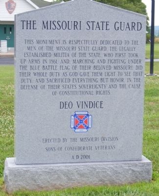
Missouri State Guard
Sons of Confederate Veterans
Deo Vindice.
Erected 2001 by Erected by the Missouri Division, Sons of Confederate Veterans.
Topics and series. This historical marker is listed in this topic list: War, US Civil. In addition, it is included in the Sons of Confederate Veterans/United Confederate Veterans series list. A significant historical year for this entry is 1861.
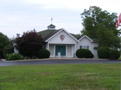
Location. 37° 7.068′ N, 93° 25.554′ W. Marker is in Republic, Missouri, in Greene County. It is in Brookline Township. Marker is on West Farm Road 182. This marker is on the grounds of the Civil War Museum which is part of the Wilson Creek National Battlefield. The Museum is administrated by the National Park Service. Touch for map. Marker is at or near this postal address: 6727 W Farm Rd 182, Republic MO 65738, United States of America. Touch for directions.
Other nearby markers. At least 8 other markers are within 2 miles of this marker, measured as the crow flies. The Battle of Oak Hills (approx. 0.4 miles away); Battle's Beginning ... and End (approx. 0.7 miles away); Signs From The Past (approx. one mile away); Bloody Hill (approx. one mile away); Gibson's Mill Site (approx. one mile away); Way to the Mill (approx. one mile away); Gibson's House Site (approx. 1.1 miles away); Gibson's Mill (approx. 1.1 miles away).
Also see . . . Wilson Creek National Battlefield - National Park Service. (Submitted on December 14, 2012, by Bill Pfingsten of Bel Air, Maryland.)
Credits. This page was last revised on February 16, 2023. It was originally submitted on December 11, 2012, by Don Morfe of Baltimore, Maryland. This page has been viewed 1,145 times since then and 34 times this year. Photos: 1, 2. submitted on December 11, 2012, by Don Morfe of Baltimore, Maryland. • Bill Pfingsten was the editor who published this page.

