Near Sharpsburg in Washington County, Maryland — The American Northeast (Mid-Atlantic)
Longstreet's Command
Semmes' Brigade, McLaws' Division
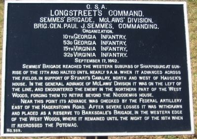
Longstreet's Command.
Semmes' Brigade, McLaws' Division.
Brig. Gen. Paul J. Semmes, Commanding.
Organization.
10th Georgia Infantry,
53rd Georgia Infantry,
15th Virginia Infantry,
32d Virginia Infantry,
September 17, 1862.
Semmes' Brigade reached the Western suburbs of Sharpsburg at sunrise of the 17th and halted until nearly 9 a.m. when it advanced across the fields, in support of Stuart's Cavalry, north and west of Hauser's House. In the general advance of McLaws' Division it was on the left of the line, and encountered the enemy in the northern part of the West Woods, forcing them to retire beyond the Nicodemus House.
Near this point its advance was checked by the Federal artillery east of the Hagerstown Road. After severe losses it was withdrawn and placed as a reserve to Barksdale's Brigade, in the western edge of the West Woods, where it remained until the night of the 18th when it recrossed the Potomac.
Erected by Antietam Battlefield Board. (Marker Number 359.)
Topics and series. This historical marker is listed in this topic list: War, US Civil. In addition, it is included in the Antietam Campaign War Department Markers series list. A significant historical month for this entry is September 1918.
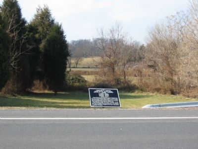
Location. 39° 29.018′ N, 77° 45.136′ W. Marker is near Sharpsburg, Maryland, in Washington County. Marker is on Hagerstown Pike (State Highway 65), on the right when traveling south. Touch for map. Marker is in this post office area: Sharpsburg MD 21782, United States of America. Touch for directions.
Other nearby markers. At least 8 other markers are within walking distance of this marker. First Army Corps (within shouting distance of this marker); Lee's Brigade, Stuart's Cavalry Division (about 300 feet away, measured in a direct line); Hampton's Brigade, Stuart's Cavalry Division (about 300 feet away); Stuart's Cavalry Division (about 300 feet away); Battery C, 5th U.S. Artillery (about 800 feet away); a different marker also named First Army Corps (approx. 0.2 miles away); Battery B, 4th U.S. Artillery (approx. 0.2 miles away); a different marker also named First Army Corps (approx. 0.2 miles away). Touch for a list and map of all markers in Sharpsburg.
Also see . . .
1. Antietam Battlefield. National Park Service site. (Submitted on March 13, 2008, by Craig Swain of Leesburg, Virginia.)
2. Semmes' Brigade, McLaws' Division. Semmes' Brigade saw action earlier at Crampton's Gap on the 14th of September. (Submitted on March 13, 2008, by Craig Swain of Leesburg, Virginia.)

Photographed By Craig Swain, February 9, 2008
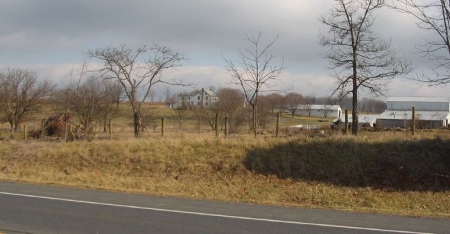
3. D.R. Miller Farm Seen from Maryland 65
Semmes' Brigade advanced north out of the West Woods in the process of driving out Sedgwick's Division. The advance carried the Brigade as far as the D.R. Miller farm before running into fire from the massed artillery on the north side of the cornfield.
Credits. This page was last revised on October 25, 2017. It was originally submitted on March 13, 2008, by Craig Swain of Leesburg, Virginia. This page has been viewed 847 times since then and 22 times this year. Photos: 1, 2, 3. submitted on March 13, 2008, by Craig Swain of Leesburg, Virginia.

