Near Quinton in New Kent County, Virginia — The American South (Mid-Atlantic)
Stuart's Ride
Tunstall’s Station
— 1862 Peninsula Campaign —
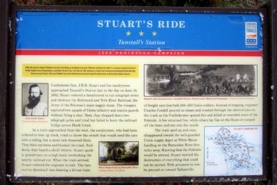
Confederate Gen. J.E.B. Stuart and his cavalrymen approached Tunstall's Station late in the day on June 13, 1862. Stuart ordered a detachment to cut telegraph wires and obstruct the Richmond and York River Railroad, the Army of the Potomac’s main supply route. The troopers captured two squads of Union infantry and station guards without firing a shot. Next, they chopped down two telegraph poles and tried but failed to burn the railroad bridge across Black Creek.
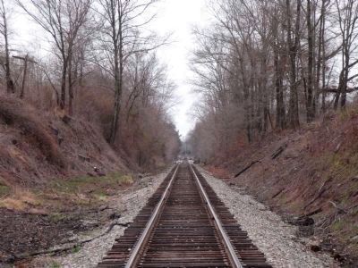
As a train approached from the west, the cavalrymen, who had been ordered to tear up track, tried to throw the switch that would send the cars onto a siding, but a stout lock thwarted them. They then cut trees and blocked the track. Suddenly, they heard a shrill whistle. Stuart quickly posted men on a high bank overlooking the nearby railroad cut. When the train arrived, Stuart ordered the engineer to halt. The locomotive, Speedwell was drawing a 20-car train of freight cars that held 200-300 Union soldiers. Instead of stopping, engineer Charles Condell poured on steam and crashed through the obstructions on the track as the Confederates opened fire and killed or wounded some of the Federals. A few returned fire, while others lay flat on the floors or jumped off the train and ran into the woods.
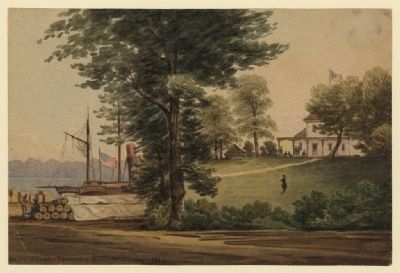
The train sped up and soon disappeared toward the well-guarded Union supply depot at White House Landing on the Pamunkey River four miles away. Knowing that the Federals would be alerted, Stuart hurried the destruction of everything that could not be carried. With prisoners in tow, he pressed on toward Talleysville.
Erected 2012 by Virginia Civil War Trails.
Topics and series. This historical marker is listed in these topic lists: Railroads & Streetcars • War, US Civil. In addition, it is included in the Virginia Civil War Trails series list. A significant historical month for this entry is May 1862.
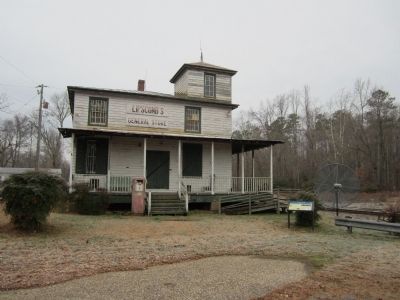
Location. 37° 34.381′ N, 77° 5.714′ W. Marker is near Quinton, Virginia, in New Kent County. Marker is on Tunstall Station Road (Virginia Route 691) 0.1 miles east of Old Church Road, on the left when traveling north. Touch for map. Marker is at or near this postal address: 11040 Tunstall Station Rd, Quinton VA 23141, United States of America. Touch for directions.
Other nearby markers. At least 8 other markers are within 5 miles of this marker, measured as the crow flies. Green v. County School Board of New Kent County (approx. 3 miles away); George W. Watkins School (approx. 3 miles away); a different marker also named Stuart's Ride (approx. 3.3 miles away); Stuart's Ride Around McClellan (approx. 3.4 miles away); The White House (approx. 3.4 miles away); St. Peter's Church (approx. 3˝ miles away); Arnold Stansley (approx. 4.7 miles away); Princess Pocahontas of Matoaka (approx. 5.1 miles away). Touch for a list and map of all markers in Quinton.
More about this marker. (captions)
Gen. J.E.B. Stuart Courtesy Library of Congress
White House Landing, Pamunkey River Courtesy Library of Congress
Stuart’s men firing at train, Tunstall’s Station, Frank Leslie’s Illustrated Newspaper – Courtesy Library of Congress
Credits. This page was last revised on November 10, 2021. It was originally submitted on December 16, 2012, by Bernard Fisher of Richmond, Virginia. This page has been viewed 1,637 times since then and 113 times this year. Photos: 1, 2, 3, 4, 5. submitted on December 16, 2012, by Bernard Fisher of Richmond, Virginia.


![A band of rebels firing into the [railroad] cars near Tunstall's Station, Virginia, June 13, 1862. Click for full size. A band of rebels firing into the [railroad] cars near Tunstall's Station, Virginia, June 13, 1862 image. Click for full size.](Photos2/228/Photo228783.jpg?12162012105200AM)
