Talleysville in New Kent County, Virginia — The American South (Mid-Atlantic)
Stuart's Ride
Baltimore Store
| — | 1862 Peninsula Campaign | — |

Photographed by Bernard Fisher, December 15, 2012
1. Stuart's Ride CWT Marker
With Lt. William Robbins, 9th Virginia Cavalry, in command of Gen. J.E.B. Stuart’s advance units, the column trotted into the village of Talleysville early in the evening of June 13, 1862. On the left (across the main road to your left) they passed a Union hospital with about 150 patients in William Talley’s house (private).
Baltimore Store stood at the crossroads to your far right along the main road, and a Union sutler occupied it. The Confederates helped themselves to canned meats, sausages, pickles, preserves, fruits, cakes, crackers, and candy, as well as wine and spirits, from the sutler’s ample stocks.
this page online
At 8:30 P.M., Stuart himself arrived and ordered a halt for three and a half hours for rest and to allow scattered detachments to close up. At midnight, the column moved on toward the Chickahominy River, with prisoners mounted double on captured mules and horses. Stuart and many of his men slept in the saddle, while pursuing Union cavalry halted at Tunstall’s four miles behind them.
(captions)
Gen. J.E.B. Stuart Courtesy Library of Congress
1862 map - Courtesy Library of Congress
Talley House – Courtesy Stran Trout
Baltimore Store, ca. 1900 - Courtesy Stran Trout
Erected 2012 by Virginia Civil War Trails.
Topics and series. This historical marker

Photographed by Bernard Fisher, December 15, 2012
2. Stuart's Ride CWT Marker
Baltimore Store stood at the crossroads in the distant right.
Location. 37° 31.718′ N, 77° 4.509′ W. Marker is in Talleysville, Virginia, in New Kent County. It can be reached from Angel's Share Drive near Old Church Road (Virginia Route 609), on the left when traveling east. Located in the New Kent Winery parking lot. Touch for map. Marker is at or near this postal address: 8440 Old Church Rd, New Kent VA 23124, United States of America. Touch for directions.

Regionally, this marker is on Virginia’s Peninsula and in Coastal Virginia. It is also in the American South, specifically in the Upper South, in the Tidewater, and on the Eastern Seaboard. Globally, it is in the North Atlantic Region, North America, the Western Hemisphere, the Western World, and the Anglosphere. Historically, it finds itself in what was once the territory of the Mississippian Culture, one of the original Thirteen Colonies, one of the Confederate States of America, and the Antebellum South.
Other nearby markers. At least 8 other markers are within
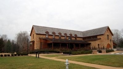
Photographed by Bernard Fisher, December 15, 2012
3. New Kent Winery
Additional commentary.
1. Baltimore Store Location
The store's specific location was where the Farmer's Market pavilion now stands, about 1,500 feet due south of the marker.
— Submitted October 24, 2026, by Evan Dwyer of Richmond, Virginia.
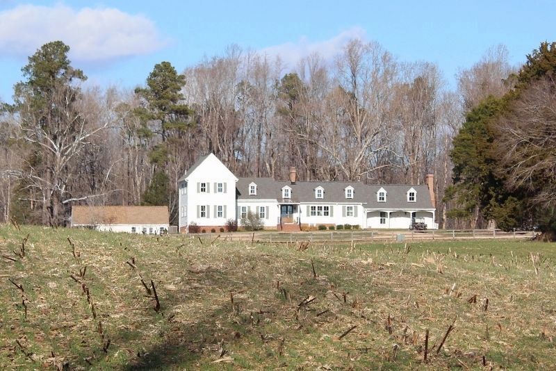
Photographed by Evan Dwyer, January 4, 2025
4. Talley House
Seen from the shoulder of New Kent Highway in the winter through the three line. The house has received significant alterations since the photo on the marker was taken. Both the west wing (2-stories, at left) and east wing (two dormer windows and its own porch roof, at right) are additions. Of the sections shown in the marker photograph, the easternmost side has been raised to a level roofline with the center portion of the house, and dormers have been added over the easternmost raised bay and over the main door. The porch has also been redone, windows have been replaced, the roof modernized, and two chimneys shown in the historic photo no longer stand, while a new one stands to the east at the far end of that addition.
Photographed by Evan Dwyer, April 26, 2025
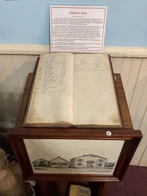
5. Baltimore Store Ledger
As well as an illustration of the store, displayed in the New Kent Historical Society Museum.
Credits. This page was last revised on October 24, 2026. It was originally submitted on December 16, 2012, by Bernard Fisher of Richmond, Virginia. This page has been viewed 1,279 times since then and 112 times this year. Photos: 1, 2, 3. submitted on December 16, 2012, by Bernard Fisher of Richmond, Virginia. 4, 5. submitted on October 24, 2026, by Evan Dwyer of Richmond, Virginia.
