Near Charles City in Charles City County, Virginia — The American South (Mid-Atlantic)
Stuart's Ride
Safe among Friends and Family
— 1862 Peninsula Campaign —
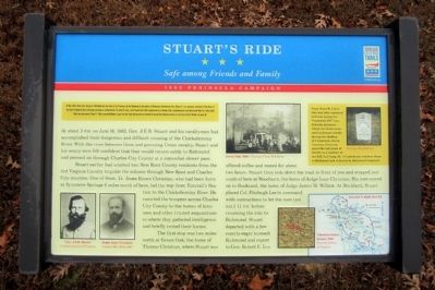
At about 1 P.M. on June 14, 1862, Gen. J.E.B. Stuart and his cavalrymen had accomplished their dangerous and difficult crossing of the Chickahominy River. With the river between them and pursuing Union cavalry, Stuart and his weary men felt confident that they would return safely to Richmond and pressed on through Charles City County at a somewhat slower pace.
Stuart earlier had selected two New Kent County residents from the 3rd Virginia Cavalry to guide the column through New Kent and Charles City counties. One of them, Lt. Jones Rivers Christian, who had been born at Sycamore Springs 6 miles north of here, led the way from Tunstall’s Station to the Chickahominy River. He escorted the troopers across Charles City County to the homes of kinsmen and other trusted acquaintances where they gathered intelligence and briefly rested their horses.
The first stop was two miles north at Green Oak, the home of Thomas Christian, where Stuart was offered coffee and rested for about two hours. Stuart then rode down the road in front of you and stopped just south of here at Woodburn, the home of Judge Isaac Christian. His men moved on to Buckland, the home of Judge James M. Wilcox. At Buckland, Stuart placed Col. Fitzhugh Lee in command with instructions to let the men rest until 11 P.M. before resuming the ride to Richmond. Stuart departed with a few escorts eager to reach Richmond and report to Gen. Robert E. Lee.
(sidebar)
Capt. Jones R. Christian was later captured and was among the “Immortal 600” Confederate prisoners whom the Union army used as human shields during the shelling of Charleston, South Carolina. Christian spent the last years of his life as a resident of the R.E. Lee Camp No. 1 Confederate Soldiers Home in Richmond and is buried at Hollywood Cemetery.
Erected 2012 by Virginia Civil War Trails.
Topics and series. This historical marker is listed in this topic list: War, US Civil. In addition, it is included in the Virginia Civil War Trails series list. A significant historical month for this entry is May 1862.
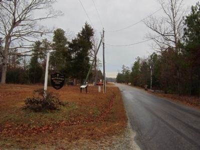
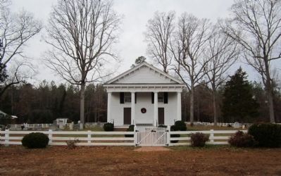
Location. 37° 22.772′ N, 77° 6.4′ W. Marker is near Charles City, Virginia, in Charles City County. Marker is at the intersection of Adkins Road (Virginia Route 618) and Church Lane, on the right when traveling south on Adkins Road. Located in front of Bethany Presbyterian Church. Touch for map. Marker is in this post office area: Charles City VA 23030, United States of America. Touch for directions.
Other nearby markers. At least 8 other markers are within 4 miles of this marker, measured as the crow flies. Old Quaker Settlement - Adkins Store (approx. 1.1 miles away); Lott Cary Birthplace (approx. 2.1 miles away); John Smith Captured by Virginia Indians (approx. 2˝ miles away); Barnetts (approx. 3 miles away); John Tyler's Birthplace (approx. 3.1 miles away); Charles City Court House (approx. 3.2 miles away); Isaac Brandon Lynched, 6 April 1892 (approx. 3.2 miles away); Veterans Memorial (approx. 3.2 miles away). Touch for a list and map of all markers in Charles City.
More about this marker. (captions)
Gen. J.E.B. Stuart Courtesy Library of Congress
Judge Isaac Christian Courtesy Mrs. Evelyn Hill
Green Oaks - Courtesy Green Oaks Farm
Christian family houses, 1862 Courtesy Library of Congress
(Lt. Christian headstone) Courtesy Jim DuPriest
Also see . . . Richmond Discoveries - Stuart's Ride. Information and map of the Stuart's Ride Civil War Trail (pdf file). (Submitted on December 16, 2012.)
Credits. This page was last revised on June 16, 2016. It was originally submitted on December 16, 2012, by Bernard Fisher of Richmond, Virginia. This page has been viewed 792 times since then and 38 times this year. Photos: 1, 2, 3. submitted on December 16, 2012, by Bernard Fisher of Richmond, Virginia.


