
Near Baldwyn in Lee County, Mississippi — The American South (East South Central)
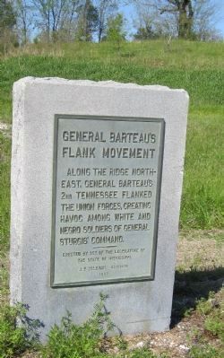
General Barteau's Flank Movement
Photographed by David Graff, April 23, 2012
1. General Barteau's Flank Movement Marker
The ridge is visible behind the marker.
Erected 1957 by State of Mississippi - J. P. Coleman, Governor.
Topics. This historical marker is listed in this topic list: War, US Civil.
Location. 34° 30.66′ N, 88° 43.972′ W. Marker is near Baldwyn, Mississippi, in Lee County. It is on Ripley Road (County Route 370) half a mile west of Bethany Road (County Route 370), on the right when traveling west. Marker is one of a pair at a pulloff near the Tishomingo Creek Bridge and at the entrance of a small park beside the creek. It is one-half mile northwest of the NPS acre at Brice's Crossroads. Touch for map. Marker is in this post office area: Baldwyn MS 38824, United States of America. Touch for directions.

Regionally, this marker is in andspecifically ast Mississippi in the North Mississippi Hills. It is also in the American South and specifically in the Deep South. Globally, it is in North America, a Gulf of Mexico state, the Western Hemisphere, the Western World, and the Anglosphere. Historically, it finds itself in what was once the territory of the Mississippian Culture, one of the Confederate States of America, and the Antebellum South.
Other nearby markers. At least 8 other markers are within walking distance of this marker: Tishomingo Creek Bridge (here, next to this marker); Chief Tishomingo (within shouting distance of this marker); Union Wagon Train (about 300 feet away, measured in a direct line); a different marker also named Tishomingo Creek Bridge (about 300 feet away); Terrain and Landscape (about 300 feet away); Spoils of War (about 300 feet away); Artillery at Log Cabin Ridge (about 400 feet away); Brice's Cross Roads
this page online
More about this marker. This location is designated as part of Stop 7 of the Brice's Crossroads Auto Tour.

Photographed by Brandon Fletcher, November 30, 2008
2. General Barteau's Flank Movement Marker
Photographed by David Graff, April 23, 2012
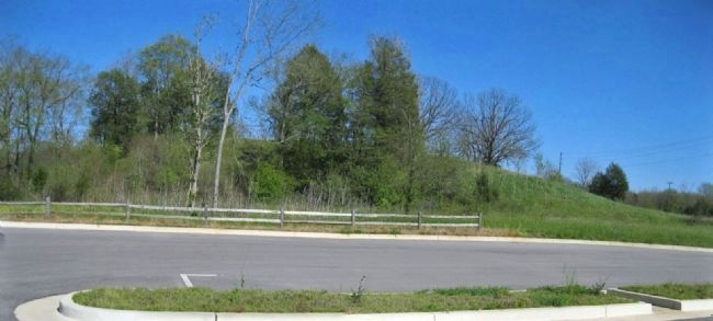
3. General Barteau's Flank Movement
Ridge overlooking Tishomingo Creek occupied by General Barteau's troops.
Credits. This page was last revised on June 16, 2016. It was originally submitted on December 18, 2012, by David Graff of Halifax, Nova Scotia. This page has been viewed 854 times since then and 25 times this year. Photos: 1. submitted on December 18, 2012, by David Graff of Halifax, Nova Scotia. 2. submitted on September 27, 2015, by Brandon Fletcher of Chattanooga, Tennessee. 3. submitted on December 18, 2012, by David Graff of Halifax, Nova Scotia. • Craig Swain was the editor who published this page.
