Saltville in Smyth County, Virginia — The American South (Mid-Atlantic)
Battle at Cedar Branch
Salt Works Defended
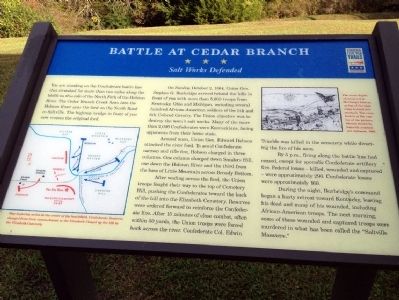
On Sunday, October 2, 1864, Union Gen. Stephen G. Burbridge arrived behind the hills in front of you with more than 5,000 troops from Kentucky, Ohio and Michigan, including several hundred African-American soldiers of the 5th and 6th Colored Cavalry. The Union objective was to destroy the town's salt works. Many of the more than 2,000 Confederates were Kentuckians, facing opponents from their home state.
Around noon, Union Gen. Edward Hobson attacked the river ford. To avoid Confederate cannon and rifle fire, Hobson charged in three columns. One column charged down Sanders Hill, one down the Holston River and the third from the base of Little Mountain across Broady Bottom.
After wading across the ford, the Union troops fought their way to the top of Cemetery Hill, pushing the Confederates toward the back of the hill into the Elizabeth Cemetery. Reserves were ordered forward to reinforce the Confederate line. After 15 minutes of close combat, often within 50 yards, the Union troops were forced back across the river. Confederate Col. Edwin Trimble was killed in the cemetery while directing the fire of his men.
By 5 p.m., firing along the battle line had ceased, except for sporadic Confederate artillery fire. Federal losses - killed, wounded and captured - were approximately 290. Confederate losses were approximately 160.
During the night, Burbridge's command began a hasty retreat toward Kentucky, leaving his dead and many of his wounded, including African-American troops. The next morning, some of these wounded and captured troops were murdered in what has been called the "Saltville Massacre."
Erected by Virginia Civil War Trails.
Topics and series. This historical marker is listed in this topic list: War, US Civil. In addition, it is included in the Virginia Civil War Trails series list. A significant historical date for this entry is October 2, 1934.
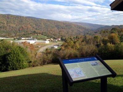
Location. 36° 53.349′ N, 81° 44.97′ W. Marker is in Saltville, Virginia, in Smyth County. Marker can be reached from Buckeye Street, 0.2 miles east of East Main Street, on the left. There is a parking lot adjacent to Buckeye Street. The marker is located on top of the knoll next to the open-sided shelter. Touch for map. Marker is in this post office area: Saltville VA 24370, United States of America. Touch for directions.
Other nearby markers. At least 8 other markers are within 8 miles of this marker, measured as the crow flies. Saltville (approx. 1.3 miles away); History of Saltville Valley (approx. 1.3 miles away); U.S. General Stoneman's Raid (approx. 2.1 miles away); Saltville Defenses (approx. 2.1 miles away); Sulphur Springs Church and Campground (approx. 6.6 miles away); Chilhowie Methodist Episcopal Church (approx. 7.1 miles away); Chilhowie (approx. 7.3 miles away); Farthest West, 1750 (approx. 7.3 miles away). Touch for a list and map of all markers in Saltville.
Credits. This page was last revised on May 29, 2023. It was originally submitted on December 19, 2012, by Duane Hall of Abilene, Texas. This page has been viewed 1,154 times since then and 60 times this year. Photos: 1, 2. submitted on December 19, 2012, by Duane Hall of Abilene, Texas. • Craig Swain was the editor who published this page.

