Old Town in Alexandria, Virginia — The American South (Mid-Atlantic)
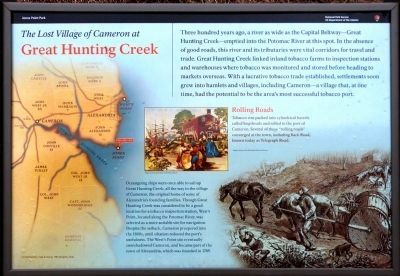
The Lost Village of Cameron at Great Hunting Creek
Jones Point Park
— National Park Service, U.S. Department of the Interior —
Inscription.
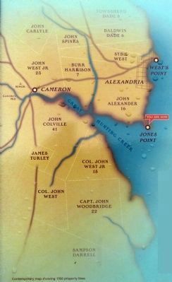
Three hundred years ago, a river as wide as the Capital Beltway—Great Hunting Creek—emptied into the Potomac River at this spot. In the absence of good roads, this river and its tributaries were vital corridors for travel and trade. Great Hunting Creek linked inland tobacco farms to inspection stations and warehouses where tobacco was monitored and stored before heading to markets overseas. With a lucrative tobacco trade established, settlements soon grew into hamlets and villages, including Cameron—a village that, at one time, had the potential to be the area's most successful tobacco port.
Oceangoing ships were once able to sail up Great Hunting Creek, all the way to the village of Cameron, the original home of some of Alexandria's founding families. Though Great Hunting Creek was considered to be a good location for at tobacco inspection station, West's Point, located along the Potomac River, was selected as a more suitable site for navigation. Despite the setback, Cameron prospered into the 1800s, until siltation reduced the port's usefulness. The West's Point site eventually overshadowed Cameron, and became part of the town of Alexandria, which was founded in 1749.
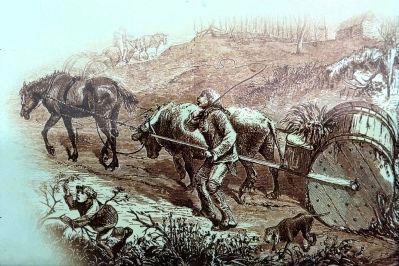
Rolling Roads
Tobacco was packed into cylindrical barrels called hogsheads and rolled to the port of Cameron. Several of these “rolling roads” converged on the town, including Back Road today known as Telegraph Road.
Erected by National Park Service, U.S. Department of the Interior.
Topics. This historical marker is listed in these topic lists: Colonial Era • Industry & Commerce • Waterways & Vessels. A significant historical year for this entry is 1749.
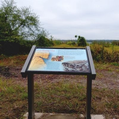
Location. 38° 47.555′ N, 77° 2.664′ W. Marker is in Alexandria, Virginia. It is in Old Town. Marker can be reached from the intersection of Jones Point Drive and South Royal Street. The marker is on a walkway along Great Hunting Creek in Jones Point Park. Touch for map. Marker is in this post office area: Alexandria VA 22314, United States of America. Touch for directions.
Other nearby markers. At least 8 other markers are within walking distance of this marker. The First People on Jones Point (about 500 feet away, measured in a direct line); World Wars to the Present (about 600 feet away); The Emerging Nation (about 600 feet away); Prehistory to Colonial Settlement (about 600 feet away); Jones Point (about 700 feet away); Mount Vernon Trail (approx. 0.2 miles away); Welcome to Jones Point Park (approx. 0.2 miles away); Potomac Connections (approx. 0.2 miles away). Touch for a list and map of all markers in Alexandria.
Additional commentary.
1. The Village of Cameron
Cameron was where Telegraph Road (VA 611) crosses Hunting Creek near I-95 exit 176 A.
— Submitted December 19, 2012, by Allen C. Browne of Silver Spring, Maryland.
Credits. This page was last revised on January 28, 2023. It was originally submitted on December 18, 2012, by Allen C. Browne of Silver Spring, Maryland. This page has been viewed 1,231 times since then and 45 times this year. Last updated on December 20, 2012, by Keith S Smith of West Chester, Pennsylvania. Photos: 1, 2, 3, 4. submitted on December 18, 2012, by Allen C. Browne of Silver Spring, Maryland. • Bernard Fisher was the editor who published this page.


