near Whitney in Hill County, Texas — The American South (West South Central)
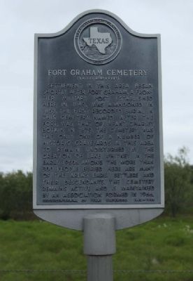
Fort Graham Cemetery
Photographed by Mike Stroud, September 14, 2012
1. Fort Graham Cemetery Marker
Sesquicentennial of Texas Statehood 1845-1995
Erected 1995 by Texas Historical Commission. (Marker Number 1985.)
Topics. This historical marker is listed in this topic list: Cemeteries & Burial Sites. A significant historical year for this entry is 1849.
Location. 32° 1.459′ N, 97° 21.123′ W. Marker is in near Whitney, Texas, in Hill County. It is on Farm to Market Road 933, on the right when traveling south. Located between White Bluff Drive and FM 2604. Touch for map. Marker is in this post office area: Whitney TX 76692, United States of America.
this page online

Regionally, this marker is in the Prairies & Lakes Region. Globally, it is in North America, a Gulf of Mexico state, the Western Hemisphere, the Western World, and the Anglosphere. Historically, it finds itself in what was once New Spain, the Republic of Texas, and one of the Confederate States of America.
Other nearby markers. At least 8 other markers are within 6 miles of this marker, measured as the crow flies: Huron (approx. 1.2 miles away); Fort Graham (approx. 2.7 miles away); Bethlehem Cemetery (approx. 4½ miles away); King Memorial United Methodist Church (approx. 5.2 miles away); Boesch House (approx. 5.3 miles away); Carver Homestead (approx. 5.4 miles away); Whitney (approx. 5.4 miles away); Whitney Messenger (approx. 5.4 miles away).
Regarding Fort Graham Cemetery. Cemetery located several miles to the west, a maze of local roads off nearby White Bluff Drive to Ft. Graham Cemetery GPS Coordinates: Latitude: 32.01250, Longitude: -97.40360
The Fort Graham Cemetery is located on Trailwood Drive inside White Bluff Resort on FM 933 between Whitney and Blum. Ask directions at the gate when
Photographed by Mike Stroud, September 14, 2012
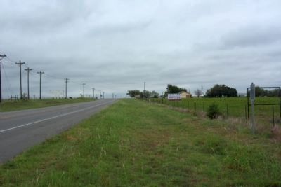
2. Fort Graham Cemetery Marker, at right, seen along FM 933, looking south
The cemetery is located several miles to the west.
Additional commentary.
1. Fort Graham Cemetery
is on a hill overlooking the Brazos River that is now part of Lake Whitney. None of the old Fort is remaining, but there is a historical marker (to be found) down the hill from the cemetery on the spot where the old Fort once stood. Many of the graves are marked with rocks and nothing else. Also, many have faded with time and were hard to read. (by Access Genealogy.com)
— Submitted December 21, 2012, by Mike Stroud of Bluffton, South Carolina.
Credits. This page was last revised on May 11, 2023. It was originally submitted on December 21, 2012, by Mike Stroud of Bluffton, South Carolina. This page has been viewed 1,500 times since then and 84 times this year. Photos: 1, 2. submitted on December 22, 2012, by Mike Stroud of Bluffton, South Carolina.
