St. Inigoes in St. Mary's County, Maryland — The American Northeast (Mid-Atlantic)
The Tulip Disaster
Photographed by Allen C. Browne, November 23, 2011
1. The Tulip Disaster Marker
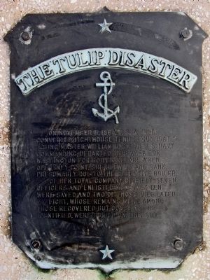
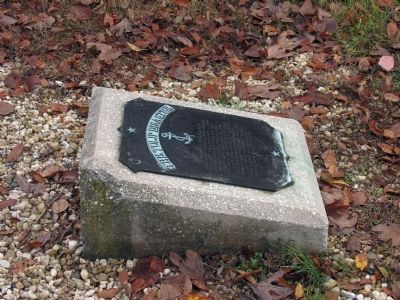
On November 11, 1864, U.S.S. Tulip converted lighthouse tender gunboat, acting master William H. Smith, U.S. Navy commanding, departed this area for Washington for boiler repair. When off Piney Point, she blew up and sank, presumably due to the defective boiler. Of her total company of fifty-seven officers and enlisted men, only ten were saved and two of those died later. Eight, whose remains were among those recovered but could not be identified, were buried on this site.
Erected 1958 by Admiral A. M. Pride of the Patuxent Naval Air Test Center.
Topics. This historical marker is listed in this topic list: War, US Civil. A significant historical date for this entry is November 11, 1864.
Location. 38° 9.731′ N, 76° 25.438′ W. Marker is in St. Inigoes, Maryland, in St. Mary's County. It can be reached from Cross Manor Road. The marker is at the end of a grassy lane running north from Cross Manor Road just east of the gates of Cornwaleys' Cross Manor. Touch for map. Marker is in this post office area: Saint Inigoes MD 20684, United States of America. Touch for directions.

Regionally, this marker is in Southern Maryland. It is also
this page online
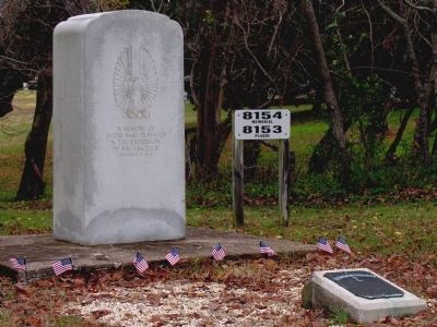
Other nearby markers. At least 8 other markers are within 2 miles of this marker, measured as the crow flies: USS Tulip Monument (here, next to this marker); Disaster at Ragged Point (here, next to this marker); The Union's Defense (a few steps from this marker); St. Ignatius Church (approx. 0.8 miles away); John LaFarge, S.J. (approx. 0.8 miles away); Historic St. Mary's City (approx. 1.3 miles away); The Manor of Cornwaleys’ Cross (approx. 1.3 miles away); a different marker also named Historic St. Mary's City (approx. 1.4 miles away). Touch for a list and map of all markers in St. Inigoes.
Related markers. Click here for a list of markers that are related to this marker. This cluster of markers and monuments tell the story
Photographed by Allen C. Browne, November 23, 2011
2. The Tulip Disaster Marker
Photographed by Allen C. Browne, November 23, 2011
3. The Tulip Disaster Marker
Credits. This page was last revised on December 26, 2025. It was originally submitted on December 27, 2012, by Allen C. Browne of Silver Spring, Maryland. This page has been viewed 1,234 times since then and 37 times this year. Photos: 1, 2, 3. submitted on December 27, 2012, by Allen C. Browne of Silver Spring, Maryland. • Bill Pfingsten was the editor who published this page.
