Spring Hill in Maury County, Tennessee — The American South (East South Central)
The Town of Spring Hill, Tennessee
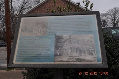
Photographed by Sandra Hughes, December 27, 2012
1. The Town of Spring Hill, Tennessee Marker
Intersection of Main Street and Depot Street
Looking North
c. late 1800s
In 1935 the Tennessee Children's Home opened in Spring Hill. In 1938 a disastrous fire destroyed the entire business district on the eastern side of town, and another conflagration in 1940 damaged much of the western business district. A tornado in January 1963 also devastated the community. The town's population had remained steady at approximately
this page online
Topics. This historical marker is listed in this topic list: War, US Civil. A significant historical month for this entry is January 1963.
Location. 35° 45.06′ N, 86° 55.832′ W. Marker is in Spring Hill, Tennessee, in Maury County. It is at the intersection of Main Street (U.S. 31) and Depot Street, on the right when traveling south on Main Street. Touch for map. Marker is at or near this postal address: 5317 Main Street, Spring Hill TN 37174, United States of America. Touch for directions.

Regionally, this marker is in Middle Tennessee and in Greater Nashville. It is also in the American South and specifically in the Upper South. Globally, it is in North America, the Western Hemisphere, the Western World, and the Anglosphere. Historically, it finds itself in what was once the territory of the Mississippian Culture, one of the Confederate States of America, and the Antebellum South.
Other nearby markers. At least 8 other markers are within walking distance
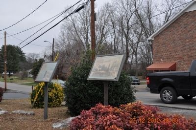
Photographed by Sandra Hughes, December 27, 2012
2. The Town of Spring Hill, Tennessee Marker
Another marker is no longer nearby. Branham and Hughes Military Academy (was approx. ¼ mile away but has been confirmed missing).

Photographed by Sandra Hughes, December 27, 2012
3. The Town of Spring Hill, Tennessee Marker
Is just feet away from Ewell Marker located corner of Main St and Depot St.
Credits. This page was last revised on June 16, 2016. It was originally submitted on December 28, 2012, by Sandra Hughes Tidwell of Killen, Alabama, USA. This page has been viewed 1,384 times since then and 99 times this year. Photos: 1, 2, 3. submitted on December 28, 2012, by Sandra Hughes Tidwell of Killen, Alabama, USA. • Craig Swain was the editor who published this page.
