Marker Logo
THE HISTORICAL
MARKER DATABASE
“Bite-Size Bits of Local, National, and Global History”
New Bedford in Bristol County, Massachusetts — The American Northeast (New England)
 

Working Waterfront

New Bedford Whaling National Historic Park

— National Park Service, U.S. Department of the Interior —


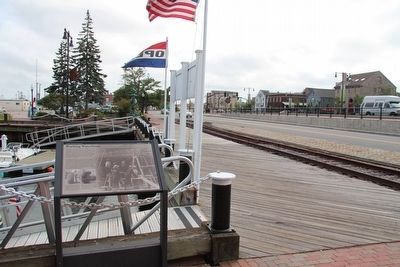
Working Waterfront Marker image. Click for full size.
Photographed by Don Morfe, September 30, 2010
1. Working Waterfront Marker
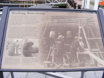
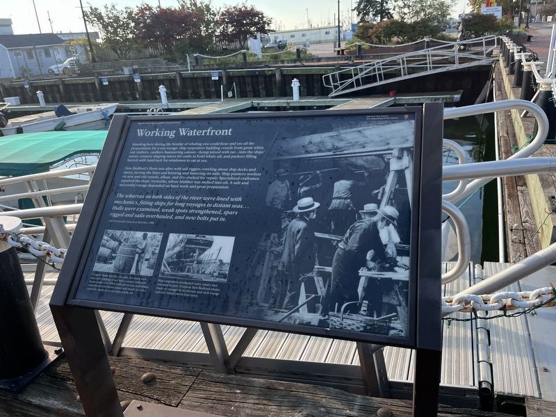
Inscription. Working Waterfront-Standing here during the heyday of whaling you would have seen and heard the bustling of a whaling port preparing for sea: ship carpenters building vessels from great white oak timbers, and caulkers hammering oakum---hemp mixed with tar---into the ships’ seams. Coopers shaped staves for casks that would hold whale oil. And packers packed barrels with hard tack for whalemen to eat at sea.

New Bedford’s wharves were alive with sail riggers crawling about ship decks and masts, tarring the lines and hoisting and fastening on sails. Ship painters worked on new and old vessels afloat and dry—docked for repair. Specialized craftsmen repaired the ships’ tryworks, where blubber was melted into oil. Much work and preparation was always necessary to ensure a safe and successful voyage.

Coopers made casks for many uses and each whaling vessel had a cooper onboard. Some casks were fitted with provisions and others contained extra barrel staves and heads so casks could be made at sea to store whale oil.

Ship carpenters overhauled every whaler that returned to port. A typical New Bedford whaler made six voyages in its lifetime and each voyage typically lasted two to four years. (Photos Courtesy New Bedford Whaling Museum)

The wharves on both sides of the river were lined with mechanics, fitting ships for long voyages to distant seas…. Hulls were examined, weak spots strengthened, spars rigged and sails overhauled, and new bolts put in.
 
Erected by National

Paid Advertisement
Click or scan to see
this page online
Park Service.
 
Topics. This historical marker is listed in this topic list: Waterways & Vessels.
 
Location. 41° 38.142′ N, 70° 55.26′ W. Marker is in New Bedford, Massachusetts, in Bristol County. It is on MacArthur Drive-Pier 3. Touch for map. Marker is in this post office area: New Bedford MA 02740, United States of America. Touch for directions.

Regionally, this marker is in the South Coast. It is also in the American Northeast and in New England. Globally, it is in the North Atlantic Region, North America, the Western Hemisphere, the Western World, and the Anglosphere. Historically, it finds itself in what was once one of the original Thirteen Colonies.

Other nearby markers. At least 8 other markers are within walking distance of this marker: Whaling Capital (here, next to this marker); From Whales to Flatfish and Scallops (within shouting distance of this marker); Commonwealth of Toil (about 300 feet away, measured in a direct line); The Dartmouth (about 300 feet away); From Whales to Bales (about 300 feet away); New Bedford Lights the World (about 500 feet away);
Working Waterfront Marker image. Click for full size.
Photographed by Don Morfe, September 30, 2010
2. Working Waterfront Marker
Rodman Candleworks (about 500 feet away); Utility Over Elegance (about 500 feet away). Touch for a list and map of all markers in New Bedford.
 
Working Waterfront Marker image. Click for full size.
Photographed by Don Morfe, September 30, 2010
3. Working Waterfront Marker
Working Waterfront Marker image. Click for full size.
Photographed by Don Morfe, September 30, 2010
4. Working Waterfront Marker
Working Waterfront Marker image. Click for full size.
Photographed by Dale K. Benington, July 30, 2015
5. Working Waterfront Marker
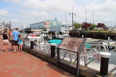
View of the marker looking east towards the wharf.
Working Waterfront Marker image. Click for full size.
Photographed by Dale K. Benington, July 30, 2015
6. Working Waterfront Marker
View of the marker looking south along MacArthur Drive.
Working Waterfront Marker image. Click for full size.
Photographed by Adam Margolis, September 15, 2025
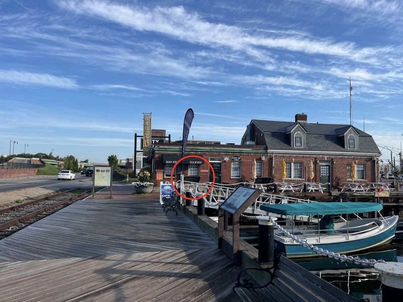
7. Working Waterfront Marker
Working Waterfront Marker image. Click for full size.
Photographed by Adam Margolis, September 15, 2025
8. Working Waterfront Marker
 
 
Credits. This page was last revised on November 22, 2025. It was originally submitted on January 6, 2013, by Don Morfe of Baltimore, Maryland. This page has been viewed 596 times since then and 16 times this year. Photos:   1, 2, 3, 4. submitted on January 6, 2013, by Don Morfe of Baltimore, Maryland.   5, 6. submitted on August 5, 2015, by Dale K. Benington of Toledo, Ohio.   7, 8. submitted on November 20, 2025, by Adam Margolis of Mission Viejo, California. • Bill Pfingsten was the editor who published this page.

m=62410

CeraNet Cloud Computing sponsors the Historical Marker Database.
This website earns income from purchases you make after using our links to Amazon.com. We appreciate your support.
Paid Advertisement
Jul. 7, 2026