Near Fort Oglethorpe in Walker County, Georgia — The American South (South Atlantic)
3rd Kentucky Infantry Regiment (US Volunteers)
Photographed by Dale K. Benington, July 17, 2012
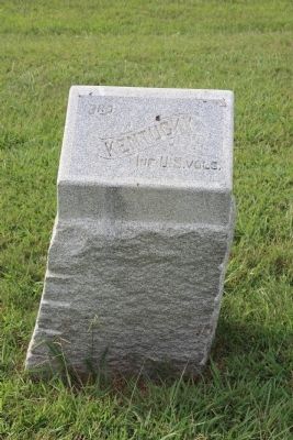
1. 3rd Kentucky Infantry Regiment (US Volunteers) Marker
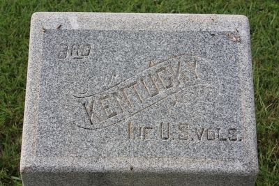
Kentucky
Inf. U.S. vols.
Erected 1899 by the State of Kentucky. (Marker Number MT-864.)
Topics. This memorial is listed in this topic list: War, US Civil.
Location. 34° 55.77′ N, 85° 16.054′ W. Memorial is near Fort Oglethorpe, Georgia, in Walker County. It can be reached from Vittetoe Road west of Vittetoe-Chickamauga Road, on the right when traveling west. This monument is located in the northwest section of the Chickamauga National Military Park, along a ridge called Snodgrass Hill. To view this monument drive to the parking area in front of the Snodgrass House and the monument can be seen situated in the field just to the northeast of the Snodgrass House. Touch for map. Memorial is in this post office area: Fort Oglethorpe GA 30742, United States of America. Touch for directions.

Regionally, this memorial is in Georgia’s Mountains. It is also in the American South, specifically in the Deep South, in Appalachia, and specifically in Southern Appalachia. Globally, it is in North America, the Western Hemisphere, the Western World, and the Anglosphere. Historically, it finds itself in what was once the original Cherokee Nation, the territory of the Mississippian Culture, one of the original Thirteen Colonies, one of the Confederate States of America, and the Antebellum South.
Other nearby markers. At least 8 other markers are within walking distance of this marker: Sirwell's Brigade (here, next to this marker); Harker's Brigade (a few steps from this marker); 37th Indiana Infantry (a few steps from this marker); 64th Ohio Infantry (a few steps from this marker); Wood's Division (a few steps from this marker); 65th Ohio Infantry (within shouting distance of this marker); 41st Ohio Infantry (within shouting distance of this marker);
this page online
More about this memorial. According to the description information provided by the National Park Service, the monument is, “1'8" x 1'2" x 3'2" high, marker is a single block of granite, rock-faced at bottom and finished above, with a slanting top inscribed with "Kentucky" within a scroll and the unit's name.”
I used the "Chickamauga Battlefield" map, that I purchased at the Chickamauga and Chattanooga National Military Park, Visitor Center, to determine both the marker number for this monument and the monument's location in relation to the rest of the park's monuments, markers, and tablets. According to the map it provides the, "numerical listing of all monuments, markers, and tablets on the Chickamauga Battlefield (using the Chick-Chatt NMP Monument Numbering System).”
Photographed by Dale K. Benington, July 17, 2012
2. 3rd Kentucky Infantry Regiment (US Volunteers) Marker
Close-up view of the text on the monument.
Photographed by Dale K. Benington, July 17, 2012
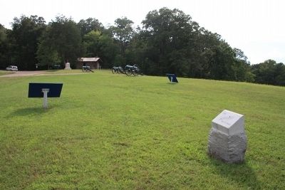
3. 3rd Kentucky Infantry Regiment (US Volunteers) Marker
View of the monument looking southwest, with a distant view of the Snodgrass House situated near the tree line.
Photographed by Dale K. Benington, July 17, 2012
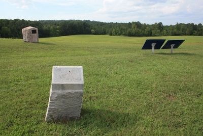
4. 3rd Kentucky Infantry Regiment (US Volunteers) Marker
View of the monument, looking west, on the crest line along with other Union monument.
Credits. This page was last revised on October 21, 2020. It was originally submitted on January 7, 2013, by Dale K. Benington of Toledo, Ohio. This page has been viewed 647 times since then and 33 times this year. Photos: 1, 2, 3, 4. submitted on January 7, 2013, by Dale K. Benington of Toledo, Ohio.
