Near South Hutchinson in Reno County, Kansas — The American Midwest (Upper Plains)
Reno County Salt Discovery Site
Photographed by William Fischer, Jr., August 25, 2012
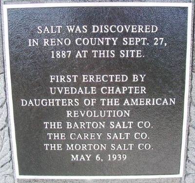
1. Reno County Salt Discovery Site Marker
Reno County Sept. 27, 1887
at this site.
Erected 1939 by City of South Hutchinson, Uvadale Chapter, D.A.R.; The Barton Salt Co.; The Carey Salt Co.; and The Morton Salt Co.
Topics and series. This historical marker is listed in these topic lists: Environment • Industry & Commerce • Settlements & Settlers. In addition, it is included in the Daughters of the American Revolution (DAR) series list. A significant historical date for this entry is September 27, 2001.
Location. 38° 0.822′ N, 97° 56.751′ W. Marker is near South Hutchinson, Kansas, in Reno County. It is on Des Moines Avenue ¼ mile west of Main Street, on the left when traveling west. Marker is at a roadside park just north of US Hwy 50. Touch for map. Marker is in this post office area: Hutchinson KS 67501, United States of America. Touch for directions.

Regionally, this marker is in Central Kansas. It is also in the American Midwest, in the Corn Belt, on the prairies, and on the Southern Plains. Globally, it is in North America, the Western Hemisphere, the Western World, and the Anglosphere. Historically, it finds itself in what
this page online
Other nearby markers. At least 8 other markers are within 3 miles of this marker, measured as the crow flies: Ben Blanchard and Reno County Salt (here, next to this marker); Hess Feed Store (approx. 2.6 miles away); American Hotel (approx. 2.6 miles away); Magers Agricultural Implements (approx. 2.6 miles away); O'Brian's Grocery (approx. 2.6 miles away); Hutchinson Implement Co. (approx. 2.6 miles away); Hutchinson Auto and Tractor School (approx. 2.6 miles away); Warren G. Harding (approx. 2.7 miles away).
More about this marker. This is apparently a replacement marker for an earlier D.A.R. marker on the site.
Also see . . .
1. Kansas Underground Salt Museum. (Submitted on January 13, 2013, by William Fischer, Jr. of Reynoldsburg, Ohio.)
2. Salt in Kansas. (Submitted on January 13, 2013, by William Fischer, Jr. of Reynoldsburg, Ohio.)
Photographed by William Fischer, Jr., August 25, 2012
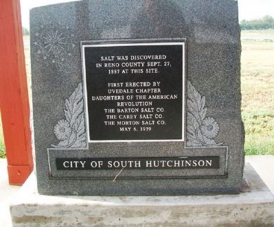
2. Reno County Salt Discovery Site Marker
Photographed by William Fischer, Jr., August 25, 2012
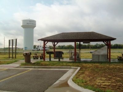
3. Reno County Salt Discovery Site Pavilion
Credits. This page was last revised on June 16, 2016. It was originally submitted on January 13, 2013, by William Fischer, Jr. of Reynoldsburg, Ohio. This page has been viewed 464 times since then and 22 times this year. Photos: 1, 2, 3. submitted on January 13, 2013, by William Fischer, Jr. of Reynoldsburg, Ohio.
