Near Sharpsburg in Washington County, Maryland — The American Northeast (Mid-Atlantic)
Jackson's Command
Starke's Brigade, Jackson's Division
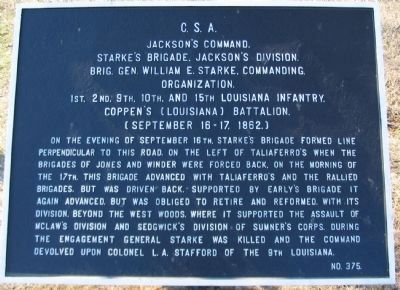
Jackson's Command,
Starke's Brigade, Jackson's Division
Brig. Gen. William E. Starke, Commanding.
Organization.
1st, 2nd, 9th, 10th, and 15th Louisiana Infantry,
Coppen's (Louisiana) Battalion.
(September 16-17, 1862.)
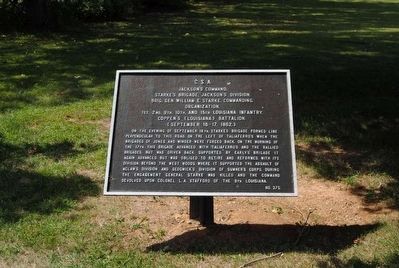
On the evening of September 16th, Starke's Brigade formed line perpendicular to this road, on the left of Taliaferro's. When the brigades of Jones and Winder were forced back, on the morning of the 17th, this brigade advanced with Taliaferro's and the rallied brigades, but was driven back. Supported by Early's Brigade it again advanced, but was obliged to retired and reformed, with its division, beyond the West Woods, where it supported the assault of McLaw's Division and Sedgwick's Division of Sumner's Corps. During the engagement General Starke was killed and the command devolved upon Colonel L.A. Stafford of the 9th Louisiana.
Erected by Antietam Battlefield Board. (Marker Number 375.)
Topics and series. This historical marker is listed in this topic list: War, US Civil. In addition, it is included in the Antietam Campaign War Department Markers series list. A significant historical date for this entry is September 16, 1962.
Location. 39° 28.679′ N, 77° 44.85′ W. Marker is near Sharpsburg , Maryland, in Washington County. Marker is on Dunker Church Road / Old Hagerstown Pike, on the right when traveling south. Touch for map. Marker is in this post office area: Sharpsburg MD 21782, United States of America. Touch for directions.
Other nearby markers. At least 10 other markers are within walking distance of this marker. A different marker also named Jackson's Command (within shouting distance of this marker); a different marker also named Jackson's Command (within shouting distance of this marker); Brigadier General William E. Starke (about 400 feet away, measured in a direct line); "We May Never Meet Again" (about 500 feet away); Philadelphia Brigade Park (about 500 feet away); Philadelphia Brigade Monument (about 500 feet away); a different marker also named Jackson's Command (about 500 feet away); The Onward Rush to Victory or Defeat (about 600 feet away); "With Flags Flying" (about 600 feet away); "The Jaws of Death" (about 600 feet away). Touch for a list and map of all markers in Sharpsburg.
More about this marker. The tablet text identifies Sedgwick's Division of Sumner's II Federal Corps, which was the target of the McLaws' Confederate divisional attack mentioned.
Also see . . .
1. Antietam Battlefield. National Park Service site. (Submitted on March 16, 2008, by Craig Swain of Leesburg, Virginia.)
2. Starke's Brigade. General Starke assumed command of Jackson's Division when General J.R. Jones was incapacitated. Replacing Starke was Col. Jessie Williams of the 2nd Louisiana. Williams was wounded about the same time Starke was killed, and replaced by Col. Leroy Stafford of the 9th Louisiana. (Submitted on March 16, 2008, by Craig Swain of Leesburg, Virginia.)
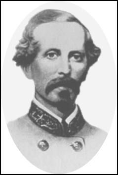
3. William E. Starke. William Edwin Starke (1814 – September 17, 1862) was a wealthy Gulf Coast businessman and a brigadier general in the Confederate States Army during the American Civil War. He was killed in action at the Battle of Antietam while commanding the famed "Stonewall Division," a unit first made famous under Stonewall Jackson. (Submitted on October 16, 2015, by Brian Scott of Anderson, South Carolina.)
Photographed By Craig Swain, February 9, 2008
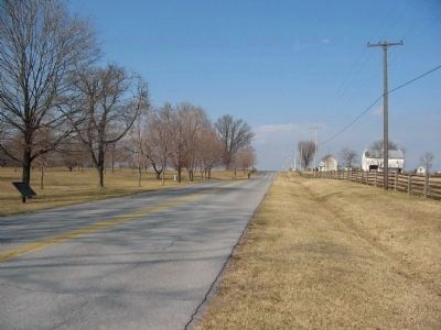
3. Hagerstown Pike near the Northeast Corner of the West Woods
Starke's Brigade marker is on the left. During the counterattacks against the Federal I Corps' morning advance, Starke's Brigade wheeled from a position to the west (left) and fronted the Pike here, facing east.
Photographed By Craig Swain, March 29, 2008
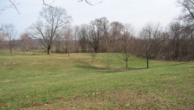
5. Starke's Brigade Wheels into Action
From near the Philadelphia Brigade monument looking out to the old Hagerstown Pike (Dunker Church Road). Starke's Brigade was holding the tree line to the right at daybreak. With the Federal advance down the Hagerstown Pike, the Brigade wheeled across the fields here and confronted the Federals on the pike in the distance.
Credits. This page was last revised on October 23, 2017. It was originally submitted on March 16, 2008, by Craig Swain of Leesburg, Virginia. This page has been viewed 924 times since then and 13 times this year. Photos: 1. submitted on March 16, 2008, by Craig Swain of Leesburg, Virginia. 2. submitted on October 16, 2015, by Brian Scott of Anderson, South Carolina. 3. submitted on March 16, 2008, by Craig Swain of Leesburg, Virginia. 4. submitted on October 16, 2015, by Brian Scott of Anderson, South Carolina. 5. submitted on August 3, 2008, by Craig Swain of Leesburg, Virginia.
