
Near Roy in Harding County, New Mexico — The American Mountains (Southwest)
Canadian River Canyon
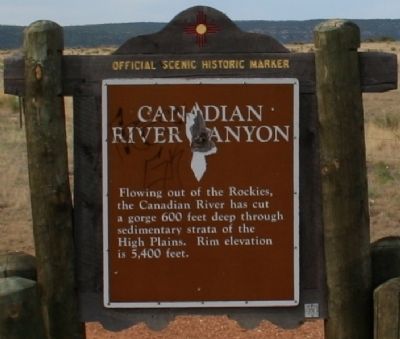
Photographed by Wade Carrington, June 27, 2010
1. Canadian River Canyon Marker
Topics. This historical marker is listed in this topic list: Natural Features.
Location. 35° 54.986′ N, 104° 21.605′ W. Marker is near Roy, New Mexico, in Harding County. It is on State Road 120, on the right when traveling east. This marker is located on the western rim of the canyon just before mile marker 63 if you are traveling east. Touch for map. Marker is in this post office area: Roy NM 87743, United States of America. Touch for directions.

Regionally, this marker is in Eastern New Mexico. It is also in the American Southwest, on the Great Plains, and specifically on the High Plains. Globally, it is in North America, the Western Hemisphere, the Western World, and the Anglosphere. Historically, it finds itself in what was once New Spain, the Comanchería, the Dust Bowl, and the Republic of Texas.
Other nearby markers. At least one other marker is within 10 miles of this marker, measured as the crow
this page online
More about this marker. Official Scenic Historic Marker
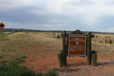
Photographed by Wade Carrington, June 27, 2010
2. Canadian River Canyon Marker
Credits. This page was last revised on June 16, 2016. It was originally submitted on January 27, 2013, by Wade Carrington of Colleyville, Texas. This page has been viewed 1,236 times since then and 30 times this year. Photos: 1, 2. submitted on January 27, 2013, by Wade Carrington of Colleyville, Texas. • Syd Whittle was the editor who published this page.
Editor’s want-list for this marker. Photos of the view of the canyon. • Can you help?
