Lima in Allen County, Ohio — The American Midwest (Great Lakes)
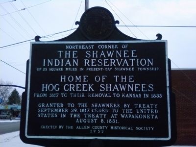
The Shawnee Indian Reservation
The Shawnee Indian Reservation
of 25 square miles in present-day Shawnee Township.
Home of the Hog Creek Shawnees
from 1817 to their removal to Kansas in 1833.
Granted to the Shawnees by treaty September 29, 1817. Ceded to the United States in the Treaty of Wapakoneta August 8, 1831.
Erected 1954 by the Allen County Historical Society.
Topics. This historical marker is listed in these topic lists: Government & Politics • Native Americans. A significant historical date for this entry is September 29, 1817.
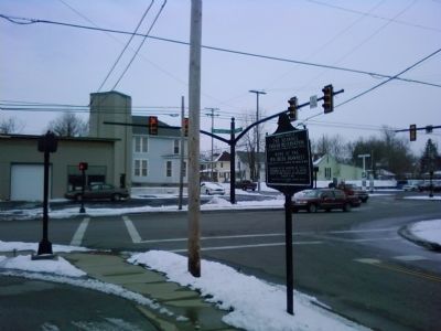
Location. 40° 43.817′ N, 84° 6.812′ W. Marker is in Lima, Ohio, in Allen County. Marker is at the intersection of West Kibby Street and South Metcalf Street, on the right when traveling west on West Kibby Street. Located near the northwest corner of the intersection, on Kibby Street headed west. Touch for map. Marker is in this post office area: Lima OH 45804, United States of America. Touch for directions.
Other nearby markers. At least 8 other markers are within walking distance of this marker. American Legion Post No. 96 Veterans Memorial Wall (approx. 0.2 miles away); Circular Street (approx. half a mile away); Solar Refinery (approx. 0.6 miles away); White House Stone (approx. 0.7 miles away); The MacDonnell House (approx. 0.7 miles away); 100th Anniversary of the end of the Great War (approx. ¾ mile away); Korean War Memorial (approx. ¾ mile away); Bessie Crayton (approx. 0.8 miles away). Touch for a list and map of all markers in Lima.
More about this marker. Information received from the Allen County Historical Museum states that the marker was placed as part of the Ohio Sesquicentennial marker project. All the markers for this project were made by the Lake Shore Marker Works of Erie, Pennsylvania. Errors in the wordage of the sign caused a delay in the actual erection of the marker until 1954, although the date on the marker says 1953 (the year of the Ohio Sesquicentennial).
Credits. This page was last revised on February 7, 2017. It was originally submitted on February 7, 2013, by Lee Hattabaugh of Capshaw, Alabama. This page has been viewed 2,128 times since then and 95 times this year. Photos: 1, 2. submitted on February 7, 2013, by Lee Hattabaugh of Capshaw, Alabama. • Bill Pfingsten was the editor who published this page.

