
Bend in Deschutes County, Oregon — The American West (Northwest)
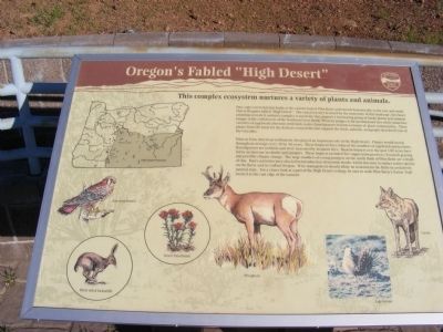
Oregon's Fabled "High Desert"
Pilot Butte Park
Photographed by Don Morfe, June 28, 2009
1. Pilot Butte Park Marker
This complex ecosystem nurtures a variety of plants and animals.
Vast, sage-covered plains begin at the eastern foot of the Pilot Butte and stretch dramatically to the east and south. This is Oregon’s fabled “High Desert”. The casual traveler is struck by the monotony of the landscape, but closer attention reveals it nurtures complex ecosystems that support a fascinating group of hardy plants and animals unique to the cold deserts of the Northern Great Basin. Western Juniper is the predominant tree while numerous varieties of sagebrush alternate with lush, native bunchgrasses to form a mosaic of plant communities. These plants form the basis for the delicate ecosystems that support the birds, animals, and people that dwell east of the Cascades.
Prior to Euro-American settlement, fire played an important role in the High Desert. Flames would sweep through on average every 20 to 40 years. These frequent fires reduced the numbers of sagebrush and junipers. Bunchgrasses are resilient and were increased by frequent fires. Human impacts over the past 100 years have led to an increase in shrubs and junipers. The
this page online
Erected by Oregon State Parks.
Topics. This historical marker is listed in this topic list: Environment.
Location. 44° 3.63′ N, 121° 17.004′ W. Marker is in Bend, Oregon, in Deschutes County. It can be reached from Pilot Butte Summit Drive. Marker is located at the Pilot View Scenic Lookout. The park can be reached from Greenwood Avenue (U.S. 20). Touch for map. Marker is in this post office area: Bend OR 97701, United States of America. Touch for directions.

Regionally, this marker is in Oregon’s High Desert. It is also in the American Mountain West and in the Lewis & Clark Corridor. Globally, it is in North America, in
Photographed by Don Morfe, June 28, 2009
2. Directional Sign Approaching the Marker
Other nearby markers. At least 8 other markers are within 2 miles of this marker, measured as the crow flies: The City of Bend (within shouting distance of this marker); "The Westward Movement" (within shouting distance of this marker); Replica of Bend's First School (approx. 0.3 miles away); O'Donnell Field (approx. 1.1 miles away); Pioneer Park (approx. 1.3 miles away); A.J. Tucker Building (approx. 1.4 miles away); Wright Hotel (approx. 1.4 miles away); Deschutes County Courthouse (approx. 1.4 miles away). Touch for a list and map of all markers in Bend.
Photographed by Don Morfe, June 28, 2009
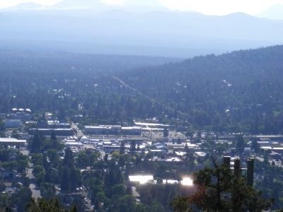
3. View From Pilot Butte Scenic Lookout
Photographed by Don Morfe, June 28, 2009
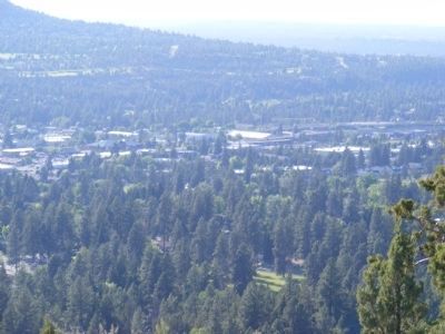
4. View From Pilot Butte Scenic Lookout
Credits. This page was last revised on June 16, 2016. It was originally submitted on February 7, 2013, by Don Morfe of Baltimore, Maryland. This page has been viewed 668 times since then and 21 times this year. Photos: 1, 2, 3, 4. submitted on February 7, 2013, by Don Morfe of Baltimore, Maryland. • Syd Whittle was the editor who published this page.
Editor’s want-list for this marker. Wide area view of the marker and its surroundings. • A view of the desert land to the east of the Butte. • Can you help?
