Downtown Kansas City in Jackson County, Missouri — The American Midwest (Upper Plains)
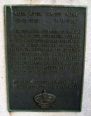
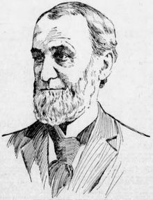
Mayor Milton Jameson Payne
10 - 29 - 1829 • 7 - 17 - 1900
This plaque to honor him placed by
The Native Sons of Kansas City Missouri
Erected by Native Sons and Daughters of Greater Kansas City.
Topics. This historical marker is listed in these topic lists: Cemeteries & Burial Sites • Charity & Public Work • Settlements & Settlers. A significant historical year for this entry is 1855.
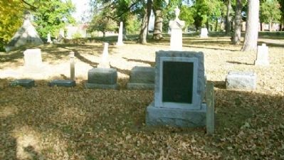
Location. 39° 4.403′ N, 94° 34.914′ W. Marker is in Kansas City, Missouri, in Jackson County. It is in Downtown Kansas City. Marker is in Union Cemetery. Touch for map. Marker is at or near this postal address: 227 East 28th Terrace, Kansas City MO 64108, United States of America. Touch for directions.
Other nearby markers. At least 8 other markers are within walking distance of this marker. Elizabeth Duncan Porter (about 300 feet away, measured in a direct line); Franklin Pierce Fisk (about 400 feet away); Lieutenant Joseph Boggs (about 500 feet away); Josephine Anderson (about 600 feet away); William Gebhardt (about 800 feet away); Catherine Purdom and Nancy Purdom Waskey (approx. 0.2 miles away); Thomas Jefferson (Squire) Goforth (approx. 0.2 miles away); Col. William Miles Chick (approx. 0.2 miles away). Touch for a list and map of all markers in Kansas City.
Also see . . . Milton Jameson Payne. Wikipedia entry (Submitted on February 8, 2013, by William Fischer, Jr. of Scranton, Pennsylvania.)
Credits. This page was last revised on February 10, 2023. It was originally submitted on February 8, 2013, by William Fischer, Jr. of Scranton, Pennsylvania. This page has been viewed 781 times since then and 13 times this year. Photos: 1. submitted on February 8, 2013, by William Fischer, Jr. of Scranton, Pennsylvania. 2. submitted on May 27, 2022, by Larry Gertner of New York, New York. 3. submitted on February 8, 2013, by William Fischer, Jr. of Scranton, Pennsylvania.


