
Forest Park in Raleigh in Wake County, North Carolina — The American South (South Atlantic)
Joel Lane House
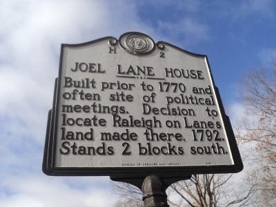
Photographed by Bill Coughlin, February 8, 2013
1. Joel Lane House Marker
Erected 1988 by Division of Archives and History. (Marker Number H-2.)
Topics and series. This historical marker is listed in these topic lists: Colonial Era • Notable Buildings • Patriots & Patriotism • War, US Revolutionary. In addition, it is included in the North Carolina Division of Archives and History series list. A significant historical year for this entry is 1770.
Location. 35° 46.862′ N, 78° 39.044′ W. Marker is in Raleigh, North Carolina, in Wake County. It is in Forest Park. It is at the intersection of Hillsborough Street and St. Mary’s Street, on the right when traveling west on Hillsborough Street. Touch for map. Marker is at or near this postal address: 800 S St Mary's St, Raleigh NC 27603, United States of America. Touch for directions.

Regionally, this marker is in North Carolina’s Piedmont and in the Research Triangle. It is also in the American South and specifically in the Upper South. Globally, it is in North America, the Western
this page online
Other nearby markers. At least 8 other markers are within walking distance of this marker: “Elmwood” (about 500 feet away, measured in a direct line); Bloomsbury or Wake Court House (about 600 feet away); Saint Mary’s School (approx. 0.2 miles away); Saint Mary’s (approx. 0.2 miles away); First Courthouse for Wake County (approx. 0.2 miles away); Raleigh Electric Company (approx. ¼ mile away); Freedmen’s Convention (approx. 0.3 miles away); Carolina Power & Light Car Barn & Automobile Garage (approx. 0.3 miles away). Touch for a list and map of all markers in Raleigh.
Regarding Joel Lane House. The date of installation of the marker is incorrect. It was installed in 1935, not 1988, one of the first four historical markers in the State of NC. (I am the curator of the Joel Lane Museum House and am basing this info on contemporary newspaper accounts and the NC Guide to Historical
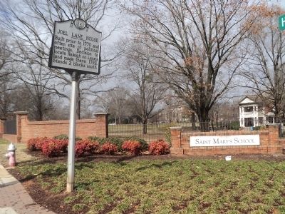
Photographed by Bill Coughlin, February 8, 2013
2. Joel Lane House Marker
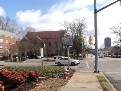
Photographed by Bill Coughlin, February 8, 2013
3. Marker on Hillsborough Street
Credits. This page was last revised on November 2, 2023. It was originally submitted on February 9, 2013, by Bill Coughlin of Woodland Park, New Jersey. This page has been viewed 766 times since then and 29 times this year. Last updated on February 11, 2013, by Belle Long of Raleigh, North Carolina. Photos: 1, 2, 3. submitted on February 9, 2013, by Bill Coughlin of Woodland Park, New Jersey. • Bill Pfingsten was the editor who published this page.
