Essex in Baltimore County, Maryland — The American Northeast (Mid-Atlantic)
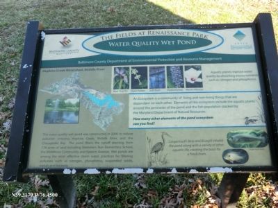
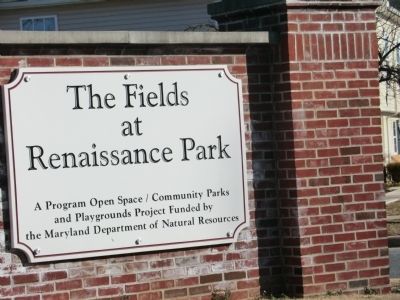
The Fields at Renaissance Park
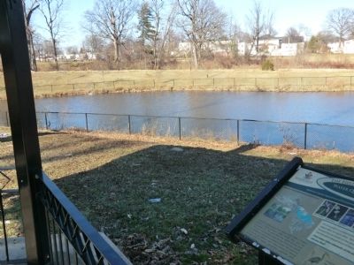
Water Quality Wet Pond
| — | Hopkins Creek Watershed, Middle River | — |
Photographed by Don Morfe, February 10, 2013
1. The Fields at Renaissance Park Marker
Aquatic plants improve water quality by absorbing excess nutrients such as nitrogen and phosphorus. An Ecosystem is a community of living and non-living things that are dependent on each other. Elements of this ecosystem include the aquatic plants around the perimeter of the pond and the fish population stocked by the Maryland Department of Natural Resources. How many other elements of the pond ecosystem can you find?
Largemouth Bass and Bluegill inhabit the pond along with a variety of other aquatic life, creating the basis for a food chain.
Erected by Baltimore County Department of Environmental Protection and Resource Management.
Topics. This historical marker is listed in this
this page online
Location. 39° 19.074′ N, 76° 27′ W. Marker is in Essex, Maryland, in Baltimore County. It is on Old Eastern Avenue 0.2 miles north of Stemmers Run Road. Touch for map. Marker is in this post office area: Essex MD 21221, United States of America. Touch for directions.

Regionally, this marker is in the Baltimore Metro Region and in Central Maryland. It is also in the American Mid-Atlantic, in the Chesapeake Bay Region, and on the Eastern Seaboard. Globally, it is in the North Atlantic Region, North America, the Western Hemisphere, the Western World, and the Anglosphere. Historically, it finds itself in what was once one of the original Thirteen Colonies and also the Antebellum South.
Other nearby markers. At least 8 other markers are within 3 miles of this marker, measured as the crow flies: The First Orems School (approx. 0.9 miles away); Sediment Removal and Restoration Project (approx. 1.1 miles away); Maryland Pioneer of US Aviation (approx. 1.3 miles away); Cox's Point Park (approx. 1.9 miles away); The Glenn L. Martin Company (approx. 2.1 miles
Photographed by Don Morfe, February 10, 2013
2. The Fields at Renaissance Park Marker
Photographed by Don Morfe, February 10, 2013
3. The Fields at Renaissance Park Marker
Photographed by Don Morfe, February 10, 2013
4. The Fields at Renaissance Park Marker
Credits. This page was last revised on June 16, 2016. It was originally submitted on February 10, 2013, by Don Morfe of Baltimore, Maryland. This page has been viewed 833 times since then and 17 times this year. Last updated on February 13, 2013, by Keith S Smith of West Chester, Pennsylvania. Photos: 1, 2, 3, 4. submitted on February 10, 2013, by Don Morfe of Baltimore, Maryland. • Bill Pfingsten was the editor who published this page.
